

 Along with its subpeak West Baldy, Mount San Antonio (aka Mount Baldy), stands a full head and shoulders over the other summits of the San Gabriel Mountains. It is one of the three famous "saintly" mountains of Southern California, San Gorgonio and San Jacinto being the other ones. There are numerous approaches to its lofty 10,064' summit, but there is no trail to the peak more worthy than the Old Mount Baldy Trail (Bear Canyon Trail) that begins in the heart of the Baldy Village. This trail is probably Southern California's fourth hardest climb (after Iron Mountain, San Jacinto from the desert, and Rabbit Peak), and when coupled with the high altitude, shade-less sections of trail, and insane steepness, this trek indeed deserves to be called "doing Baldy the hard way". It is a 6 mile one-way shot to the summit from the Village, and gain over 6000' in that time: over 1000' of vertical gain per mile! This hike is only for those in good physical condition, as there is no water en route after the village and the trail is unbelievably steep in some places. To make this trek a bit easier, consider utilizing a car shuttle to pick you up at Falls Road near Manker Flats, thus limiting the knee-pounding descent of retracing your steps. Although this trail is popular and is hiked all year long, I recommend using this trail only from April-June and again from October-November, as the lower portions of this trail are exposed to direct sunlight (painful on even a moderately warm day), and the upper portions are snow covered during the winter months.
 Stats:
Category: Extremely Strenuous

Elevation Gain: 6,100' (including West Baldy)
Location: Angeles National Forest, San Bernardino National Forest, Sheep Mountain Wilderness (no permit)
Directions: https://mapsengine.google.com/map/edit?mid=zwnKszBY9wxE.k6gEPzC_jtEE (Do not park in the church's lot-you will be towed)
 The Trail: From you parking spot, proceed up into the Mt. Baldy Village Church's parking lot onto Bear Canyon Road, passing some rustic mountain homes, Bear Creek, and "Old Glory", the world's tallest Bigcone Douglas Fir Tree. Soon, the road turns unpaved and you follow the signs up the Mt. Baldy Trail over Bear Creek, as the trail ascends above the canyon. You again, rejoin the canyon and for a few minutes pace alongside the creek-bed, shaded and relaxing... but don't get too used to it, because in a few minutes you will leave the shaded stream-side, and begin switchbacking up Chaparral-covered southern slopes and after 1.6 miles arrive at the San Gabriel Mountains' only "meadow" (not really much of one), Bear Flats Meadow. After taking a breather at the flats (you'll need it), the trail becomes unbelievably steep as it switchbacks up and up and up (you get the point) unendingly through exposed, sun-covered slopes. This is the most uncomfortable part of the trek, and in my opinion the worst. After switchbacking over 1000', you begin to hit the high county- and pines, instead of burnt brush, becomes the dominant vegetation. As you continue along the ridge, the views begin to expand before and behind you. This section of the trail is indeed steep, but because its is shaded by Ponderosa, Jeffery's and Sugars, it is more tolerable than the lower slopes. You will cross over a smooth saddle, releaving you temporarily of the steep ascent. As you approach 8000', the trail becomes rockier and granite outcroppings become more frequent. At one point there is a dramatic relief of a cliff plunging nearly vertical 3000' into Cattle Canyon-one of So Cal's most dramatic gorges. Looking ahead you spot Cattle Peak at the 9200', it is the zenith of the canyon. You soon begin traveling the 'Hardscrabble', a rocky and steep section of trail, which leads you to 'The Narrows'- and impressive ridge-line at 9000'. From here is your first real view of the San Antonio Massif, comprised of West Baldy and Mount Baldy. After traversing 'The Narrows" (one of the highlights of the trip), you climb moderately behind the north-side of Cattle Peak, where snow can linger into early summer. The vegetation here now switches from the main forest body into the sub-alpine zone, with Lodgepole and Limber Pines, Manzanita, and Chiquaquin brush being the dominant plants. Ahead of you lies "San Antonio Tarn"- a dry lake body now filled with pines, unnoticed on most maps, and most unimpressive..yet still a neat find. Keep pushing until you reach the Baldy-West Baldy Saddle at 9,800'. To the right of this magnificent sadle (one of the finest I've seen), you can continiue on a well-worn, but not "offical' climbers path about 200' to the less-visited-than-Baldy summit of West Baldy at nearly 10,000'. After enjopying your soltitue at that summit, head over to probably crowded Mount Baldy, 0.5 miles away and 200' higher than the saddle. After savoring in the views from the top return via the Devil's Backbone Trail or Ski Hut Trail, or the way you came. I opted for the Devil's Backbone Trail, back down to the Baldy notch at 7,800'. From there you can pay $10 on weekends for a ride down to near Falls Road, and your car shuttle, or hike the remaining 3.5 miles on a Falls Road down to the car. When you get to the car, thank your creator for a most enjoyable, yet insanely difficult travel in His high country.
 Note Bene: Since this climb is VERY strenuous, bring at least 100oz of water, and take the going slowly. I got Acute Mountain Sickness AFTER the hike when I got near Claremont. Delayed mountain sickness happens to some people, and can take up to 48 hours to fully recover. Lesson learned: Take steep climbs slowly!
Passion of Christ, Strengthen Me!
Hiked 4-13-2014 (Palm Sunday), Los Angeles and San Bernardino Counties. Adventure Pass Required.
 |
| 7:30 am Sunrise in San Antonio Canyon |
 |
| The Misty Mountains..... |
 |
| 'Old Glory'- The World's largest Douglas Fir |
 |
| Bear Canyon |
 |
| Lower Bear Canyon |
 |
| Southern Slopes |
 |
| Down San Antonio Canyon |
 |
| Bear Flats Meadow |
 |
| Climbing Chaparral |

 |
| Up the Chaparral |
 |
| Icehouse Canyon |
 |
| Keep going! |
 |
| Hitting the Pines |
 |
| Entrance into the High Country |
 |
| The Trail? |
 |
| After the Chaparral Climb |


 |
| Cattle Canyon |
 |
| Wow |
 |
| Cattle Peak |
 |
| The Hardscrabble |
 |
| Baldy (L) and Harwood (R) |
 |
| The Narrows |
 |
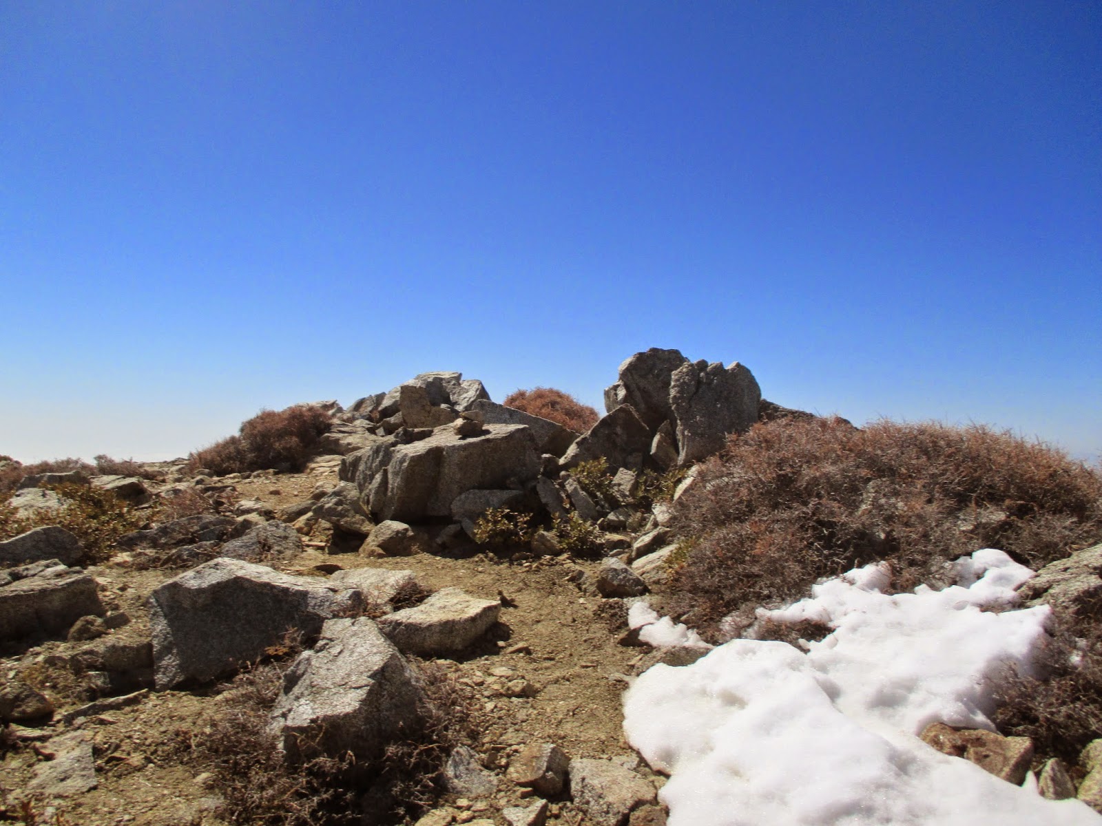
| First Snow patch at 9000' |
 |
| Looking back on The Narrows |
 |
| After The Narrows |
 |
| The Top of Cattle Canyon |
 |
| Behind Cattle Peak |


 |
| Cucamonga Wilderness |
 |
| San Antonio Tarn |
 |
| San Gorgonio Mountain |
 |
| Almost there! |
 |
| View of Pine and Dawson Peak from W. Baldy/Baldy Saddle |
 |
| Mount San Antonio |

 |
| 3:30 pm: West Baldy summit |
 |
| Trail over to Mount Baldy |
 |
| 3:40- Mount Baldy |

 |
| Summit |
 |
| Coming down Baldy |

 |
| Geo-caching! |
 |
| Northern Escarpment of Mt. Harwood |
 |
| Down into Stockton Flats |
 |
| Devil's Backbone |
 |
| Baldy Notch |
I love that trail. It's my favorite route.
ReplyDeletehttp://www.simpsoncity.com/hiking/baldytrail.html
That hand in the geocaching picture looks so familiar!
ReplyDelete