

Category: Strenuous
Miles: 8
Elevation Gain: 2000' (some on the return)
Location: Inyo National Forest, John Muir Wilderness
Directions: https://www.google.com/maps/@37.4353925,-118.747167,19z?hl=en
 The Trail: From Mosquito Flats Trailhead at the end of the road (10,236'), take the obvious trail southward, walking alongside rushing Rock Creek. In a few hundred yards you will reached the John Muir Wilderness boundary. Continue climbing, until in about 0.25 miles from the trailhead you come to a trail split. Take the path to the right, following signage towards Mono Pass. The trail steepens and climbs above the valley up the canyon wall, where the views of the lower dales and verdant meadows and higher peaks and clinging glaciers are truly awe-inspiring. You pass several small washes and one rather quaint pond along you haul up, until you reach a level section, graced with flowers and delicate grasses. with a spur trail heading off to Ruby Lake.
 Stay on the main trail, and it begins its rather abrupt switchbacks towards Mono Pass, while giving the hiker expanding vies over Ruby Lake and Lookout Peak above it. The features changes with each step, the grasses are no more, the rocks more pronounced, the air thinner, the trees gnarled and dwarf...the High Passes and peaks calling. When you round a large bend and turn northward, the treeline commences, and you are now in the full grasp of the High Sierra; sheltered from nothing, exposed to everything-- it is always a powerful moment when you enter that new realm. Continue ascending to the Pass, joined only by ice and rock, while gazing back at the even higher peaks behind and the steep peaks immediately around. You will cross a false pass, until you arrive at Mono Pass itself. Here you will find Summit Lake ahead, the Sierra Crest behind, Mount Starr to the east and Mono Pass Peak to the west.

Hiked 6/25/2015, Inyo and Fresno Counties, CA. No Permit Required.
 |
| Rock Creek |
 |
| The beginning |
 |
| Wilderness Boundary |
 |
| First views of the Sierra Crest |
 |
| Rather uninspiring Mount Morgan, the highest in the area |

 |
| Amazing |

 |
| Lookout Peak and the Sierra Crest |
 |
| Small meadows at 11,100' |
 |
| High Altitude Flowers |
 |
| The thinning Forest |
 |
| Mount Morgan (13,748')..maybe next year? |
 |
| Reaching timberline |
 |
| Ruby Lake |
 |
| Horse Packers |
 |
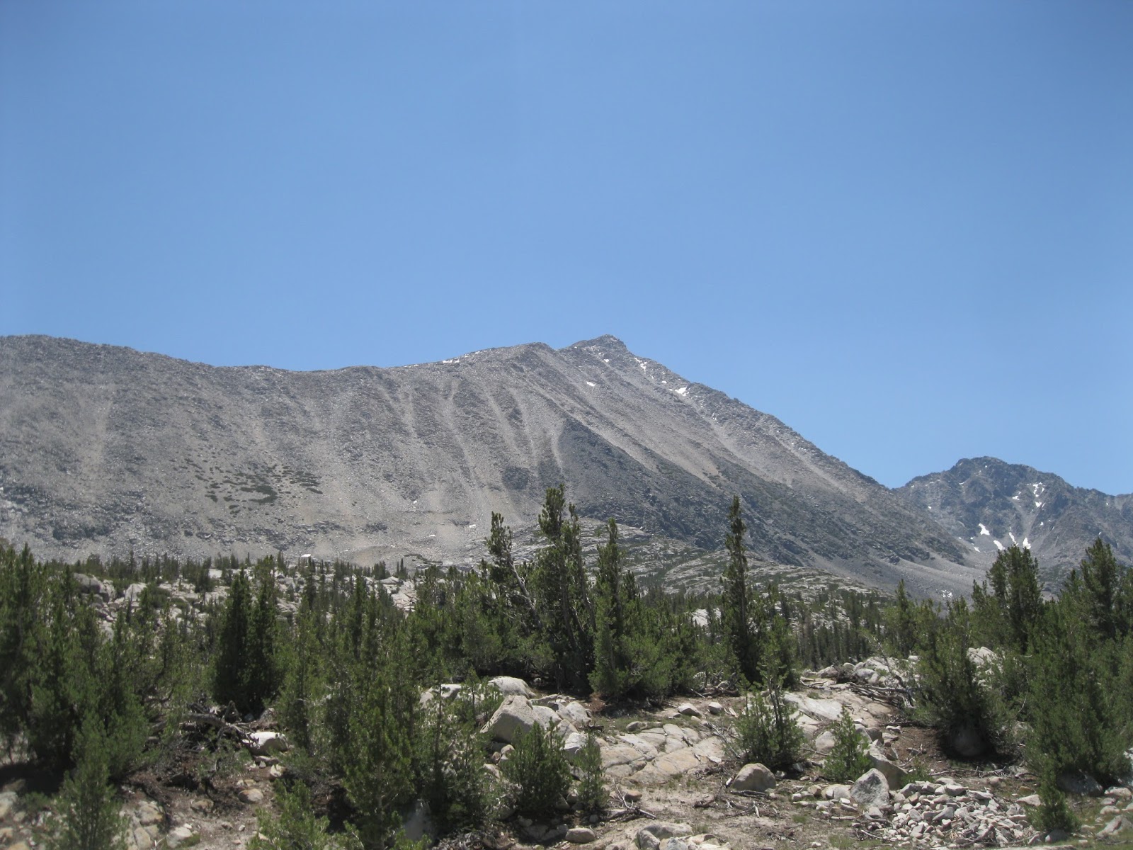
| Steep Chute on the north flank of Mono Pass Peak |
 |
| In the High Sierra now |
 |
| Is this the Himalayas or California? |
 |
| Mono Pass |
 |
| On the Pass |
 |
| The Pacific Crest from the Pass |
 |
| Summit Lake from the Pass |
 |
| Mount Starr from the Pass |
 |
| Going up the, at first, obvious use-trail |
 |
| Looking into Hilton and Mono Watersheads |
 |
| Getting Steeper |
 |
| The views expands as you get higher on Starr |
 |
| The jumble. |
 |
| Red Slate Mountain, Mono, McGee, and Hilton Watersheads |
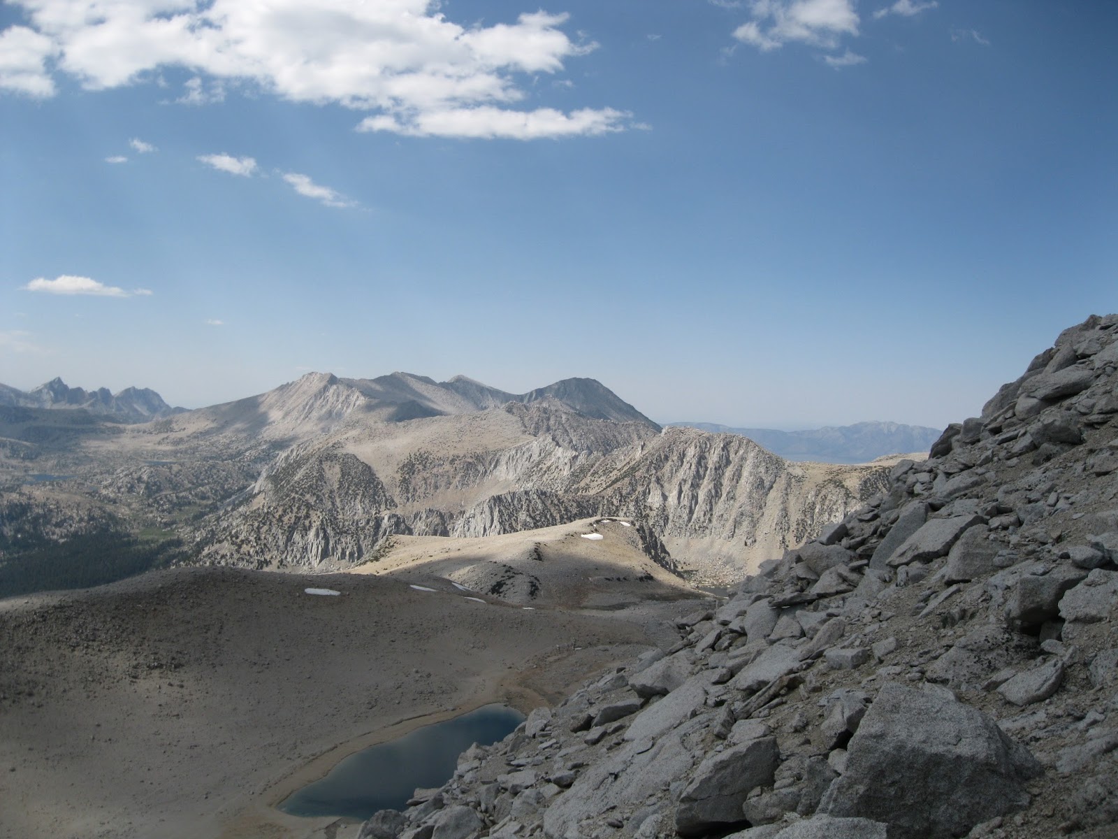 |
| Look at that slop angle. |
 |
| Where we stopped. 12,400' Too much for us to to that for another 460'. |
 |
| View from out highpoint of the day |
 |
| Glass Mountain looks a LOT like the Baldy bowl from here |
 |
| White Mountain (14,246') on the way back |

No comments:
Post a Comment