
Cony Mountain, standing alone over the virgin forests of central Wyoming, keeps watch both over the mighty glacier-carved peaks to the northwest and the semi-arid Wind River Basin to the east. At 11,110', Cony Mountain provides stunning views of both of the nearby landscapes. The Wind River Mountains, sculpted by the same rock and mighty glaciers that created the Sierra Nevada, to which they owe a remarkable visual similarity, contain both the highest peaks in Wyoming and the most glaciers in the United States outside of Alaska. A vital part of the Greater Yellowstone Ecosystem, "the Winds", as they are locally called, are both abundant in both wildlife and in alpine vegetation. Megafauna found in these mountains include the likes of Elk, Deer, Moose, Mountain Goat, Wolverine, Mountain Lion, Bald Eagle, Gray Wolf, Black Bear and Grizzly Bear. Vegetatively, the range is nearly as diverse, with Quaking Aspen and Cottonwood covering the canyon bottoms and lower hillsides, and grand White Firs and Lodgepole Pine in the up-most reaches of the range.
Compared with other sub-ranges in the Rocky Mountains, the Wind Rivers are far less visited, making for a unique wilderness experience. In fact, no roads cross the heart of the range, leaving the vast amount of land here utterly untouched and open to exploration. Cony Mountain, for example, has never had a recorded hiking trip report for the public, making this one the first. In fact almost no amount of research can merit much for information at all about Cony Mountain and nearby Blue Ridge. The lack of information though, makes this trip even more exhilarating as a true wilderness adventure. So strap on those hiking boots, read on, and discover what so many have passed by...
Stats:
Category: Strenuous
Miles: 10
Elevation Gain: 2000'
Location: Shoshone National Forest, Popo Agie Wilderness
Directions: HERE (Louis Lake Road, from Lander, WY, turns dirt at the junction of Worthen Lake Road for about 6 miles, but is suitable for any car when cleared of snow. Check with Forest Rangers if you have any doubts)
 The Trail: This hike starts on a small trail to Blue Ridge Lookout, then switches to a dirt 4x4 road, and finally turns cross-country with Class 2 sections to the summit. The Trailhead to this hike is at Blue Ridge Summit, the high point of Louis Lake Road at 9,600'. Here you will find ample parking (this area is popular with hunters in Fall), and a trail sign pointing the way to Blue Ridge Lookout 0.5 miles away; your first destination of the day. Blue Ridge Point once held a full lookout tower, but it no longer stands. However, after lightening storms the Forest Service still sends personnel to watch for forest fires in the distance. An extremely weathered USGS benchmark marks the summit, and the foundations of the old tower still remain, but it is the grand view from the rocky summit that continues calling locals to its zenith. From the top, the entire route to Cony Mountain is laid out: a long haul up and down Blue Ridge, then a scramble to the summit far in the distance.
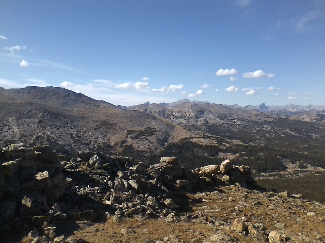
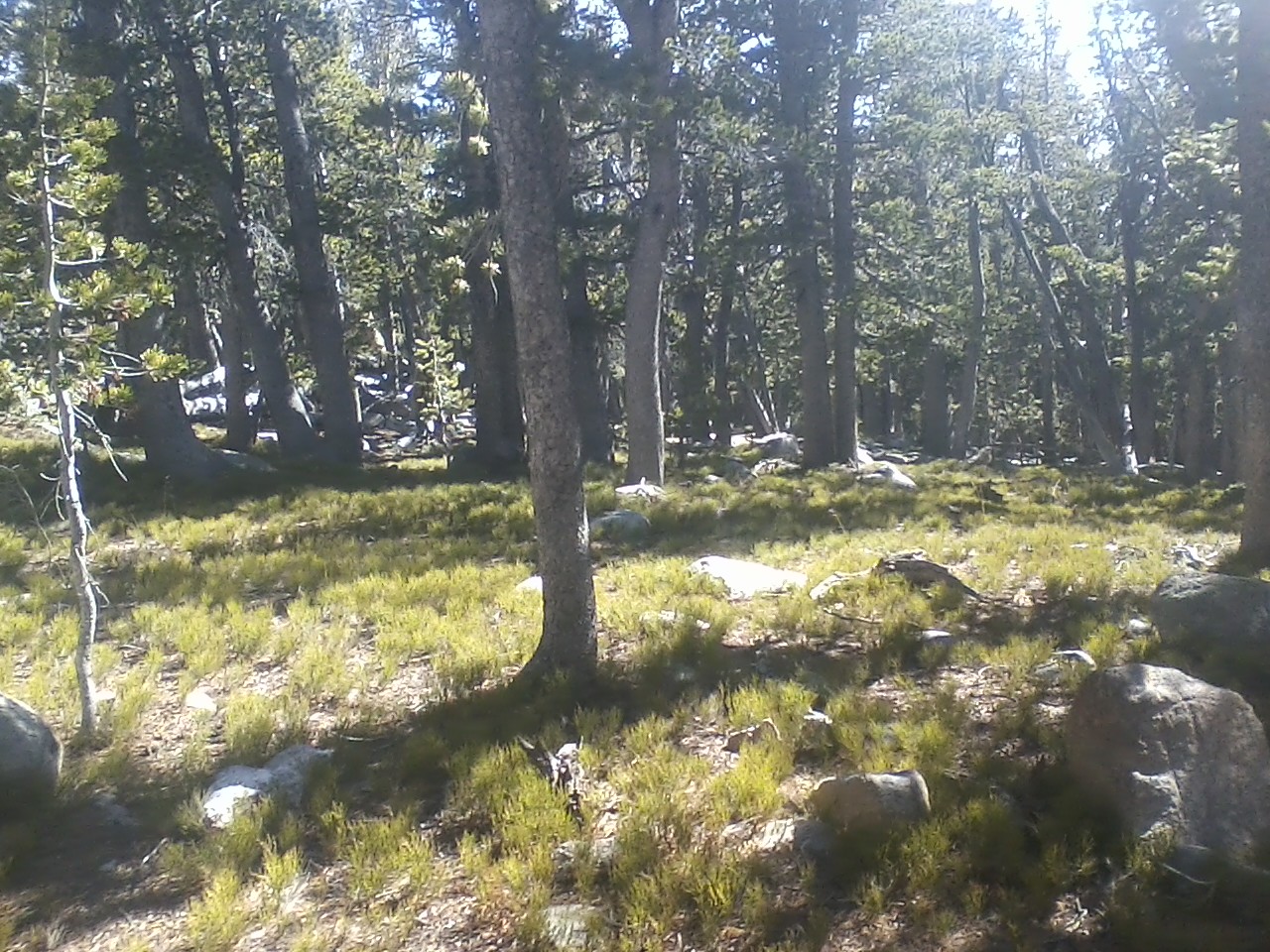
After spending some time on the lookout, head wesward toward FS Road 306, which is the main dirt road heading up the ridge. Along this roller-coaster route are found quiet meadows and still forests composed almost entirely of lodgepole pine. After 3 miles from the lookout, the rough road becomes a trail and enters into the Popo Agie Wilderness at 10,500', overlooking an expansive meadow below, and entertaining grand views of Atlantic and Moe Peaks of the southern Wind River Mountains. Take the trail down 0.5 miles through the meadow until it ends suddenly at the edge of the forest. From here, go cross-country, following the cairns when you can, but traveling in a slight north-western direction through the forest about 150' and 0.3 miles. If you have taken the right route, you will find yourself at the foot of a large boulder field, upon which you must now climb for about 120' of Class 2 scrambling. At 10,720', reenter the last of the forest and walk north, until you cross past treeline onto the Thunderbird Plateau. Continue walking north, passing a small knoll to the left, and swing left to follow the easiest route up the second Class 2 boulder wall about 100'. At the top of this wall is a false summit, so swing east again and take the path of least resistance up along relatively flat terrain, until the true summit at last comes into view northward. After a last Class 2 boulder wall (about 50' of scrambling), you will find yourself on the summit of Cony Mountain. There is no benchmark or summit register: just pure wilderness.
Here in the high country of the Wind River Mountains: the air is clean, the sun bright, and the wind strong. Enjoy the view north into the heart of the Popo Agie Wilderness, with Wind River Peak (13,150') and the distant Cirque of the Towers as the jewels of the north. To the west is the great buttress of Moe Peak (11,536') and the Atlantic Peak high country, while southward is verdant Christina Lake basin, along with Fiddlers and Louis Lakes. Finally, east and northeast holds a monumental view of rural Wyoming-including the Owl Creek Mountains, Bighorn and Wind River Basins, and the distant Absaroka Mountains. After enjoying the glory of Creation up top, climb down carefully back the way you came, taking extra precautions to follow the correct route down the boulders, and then walk back through the forest to the use-path and 4x4 road. From here, return the way you came; just be ready for those uphill sections back to the trailhead.
Hiked 10/17/2015. Fremont County, WY. No Permit Required for day use. Remember to carry Bear Spray.
 |
| The Route |
 |
| Cross-Country Section |
 |
| Trailhead (9,600'). Note the hunter's trucks |
 |
| Louis Lake Road |
 |
| The trail begins |
 |
| Trail up to Blue Ridge Lookout |
 |
| Blue Ridge Lookout climbing |
 |
| Blue Ridge Summit |
 |
| A very weathered benchmark |
 |
| Cony Mountain from Blue Ridge Summit. Almost entire route visible. |
 |
| View east |
 |
| View northwest |
 |
| Joining the 4X4 Road |
 |
| Through the Lodgepole Forest |
 |
| Dry Meadows in October |
 |
| The Road/trail |
 |
| Last summer greens.. |
 |
| Darker section of forest |
 |
| Popo Agie Wilderness Boundary |
 |
| The use trail down into the large meadow from the Wilderness Boundary |
 |
| In the Meadow--Moe Peak and Atlantic Peak high county in background |
 |
| Flanks of Cony Mountain |
 |
| Follow the use trail until it ends in the forest |
 |
| Going Cross Country at the end of the use trail |
 |
| Ending the forest-XC section |
 |
| First Boulder Field |
 |
| At the end of the First Boulder section. Last trees, before Tundra |
 |
| On Thunderbird Plateau towards the first false summit |
 |
| Getting closer the the false summit and second boulder wall |
 |
| Second Boulder Wall |
 |
| More Cross-country...up |
 |
| Second Boulder wall |
 |
| Fun Class 2 climbing |
 |
| At the end of the second boulder wall. False summit left |
 |
| True summit ahead. |
 |
| Last section of Class 2 to summit |
 |
| Summit getting closer... |
 |
| Summit view east towards Lander, WY |
 |
| View North to Popo Agie River Valley |
 |
| Northwestern View: Higher Wind River Peaks |
 |
| Moe and Atlantic Peaks |
 |
| Summit views northwest...note snow-capped Wind River Peak |
 |
| View south |
 |
| Southeast |
 |
| Summit Shadow! |
 |
| Coming back down Thunderbird Plateau... |
 |
| Back into the forest... |
 |
| Cool rocks, right before the first boulder field coming from the summit |
 |
| The First Boulder field. Watch footing. |
 |
| Nearing the end of the road... |

 The Trail: This hike starts on a small trail to Blue Ridge Lookout, then switches to a dirt 4x4 road, and finally turns cross-country with Class 2 sections to the summit. The Trailhead to this hike is at Blue Ridge Summit, the high point of Louis Lake Road at 9,600'. Here you will find ample parking (this area is popular with hunters in Fall), and a trail sign pointing the way to Blue Ridge Lookout 0.5 miles away; your first destination of the day. Blue Ridge Point once held a full lookout tower, but it no longer stands. However, after lightening storms the Forest Service still sends personnel to watch for forest fires in the distance. An extremely weathered USGS benchmark marks the summit, and the foundations of the old tower still remain, but it is the grand view from the rocky summit that continues calling locals to its zenith. From the top, the entire route to Cony Mountain is laid out: a long haul up and down Blue Ridge, then a scramble to the summit far in the distance.


No comments:
Post a Comment