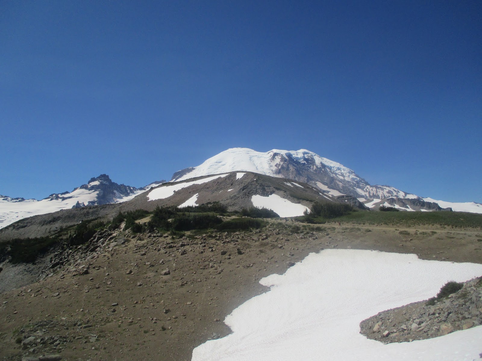
On this great planet of ours, there are some places which the Creator has deigned to be particularly visually stunning, brilliantly exquisite, and frighteningly beautiful; and then there is Mount Rainier National Park. It shares a league of natural majesty, pure sublimity, and unfettered glory with few others. Magnificent in every meaning of the word, the national park and its 14,411' namesake summit are the crown of the Pacific Northwest, ultimately a bright glittering jewel in the larger crown of the world's natural wonders.
 While attaining the summit of Mount Rainier requires technical skills that the average hiker and I do not possess, a visit to the park is a worthy addition to any nature lover's life list. Many smaller, non-technical peaks jut against the ice-clad giant, the tallest of which is Burroughs Mountain, or as locally called "Third Burroughs". Burroughs Mountain is the culmination of a series of smaller peaks also named Burroughs, principally First and Second Burroughs. Though Burroughs Mountain proper (7,828') is just over half the height of Mount Rainier, the summit and its beholden views make it an admirable endeavor in itself. There is no trek I have done to date that even nears the unique spires of nobility found in this simple trip.
Stats:
Category: Strenuous
Miles: 9.5
Elevation Gain: 2,500'
Location: Mount Rainier National Park, Mount Rainier Wilderness
Season: July-September
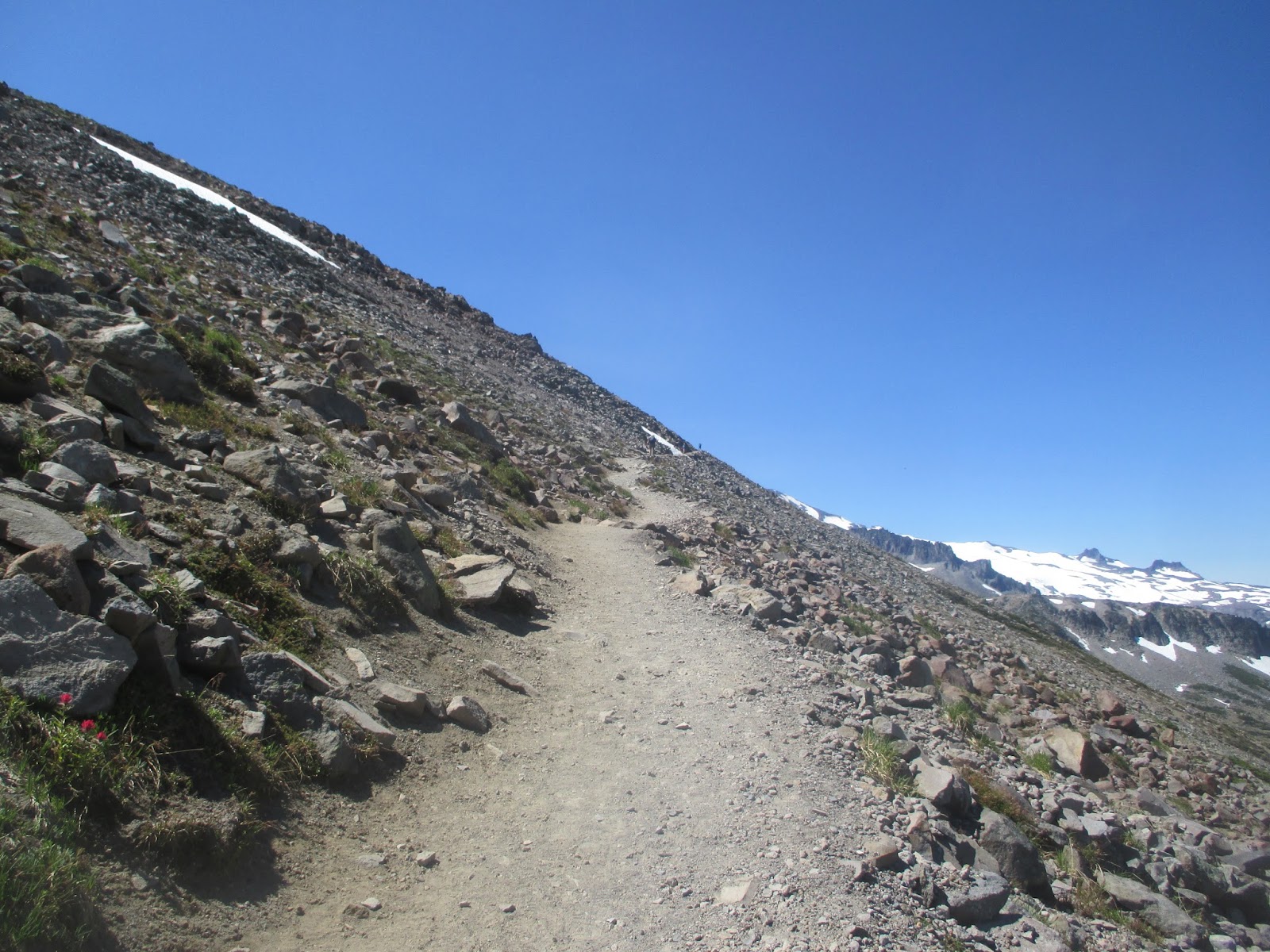
 The Trail: From the Sunrise Visitor Center, follow the signs up the Sourdough Ridge Trail towards Frozen Lake. The route gains elevation quickly as it ascends from the parking lot through lush meadows dotted by sub-alpine fir, and ringed by rocky peaks immediately above. Be sure to wear sunglasses on this trip, as the glaciers on the mountain reflects an enormous amount of the sun's rays.
Keep a sharp lookout for Mountain Goats feeding on the grasses and mosses alongside the trail. Following signage to Frozen Lake, the route passes by some excellent viewpoints extending over one hundred miles into North Cascades National Park, Glacier Peak, Mount Baker and Vancouver, Canada. Ahead looms the ice-clad, colossus eminence, Mount Rainier, sheathed by the largest glacier in the contiguous United States, the Emmons Glacier. Highest in the Northwest, Cascades, and the state of Washington, the superlatives of grandeur continue to nearly no end. Taking in such a view requires an appropriate moment of pause. Upon arriving at the Frozen Lake saddle, now completely above tree-line a mile and a half from the trailhead, follow the signage towards Burroughs Mountain. As the trail ascends, there is a crampon-ice axe warning sign, both of which may be needed in early season. Burroughs Mountain is actually a large ridge hosting three separate peaks, First Burroughs Mountain, the more scenic Second Burroughs Mountain, and finally the highest of the three: "Third" or simply "Burroughs Mountain", 7,828'. This trip ascends all three.
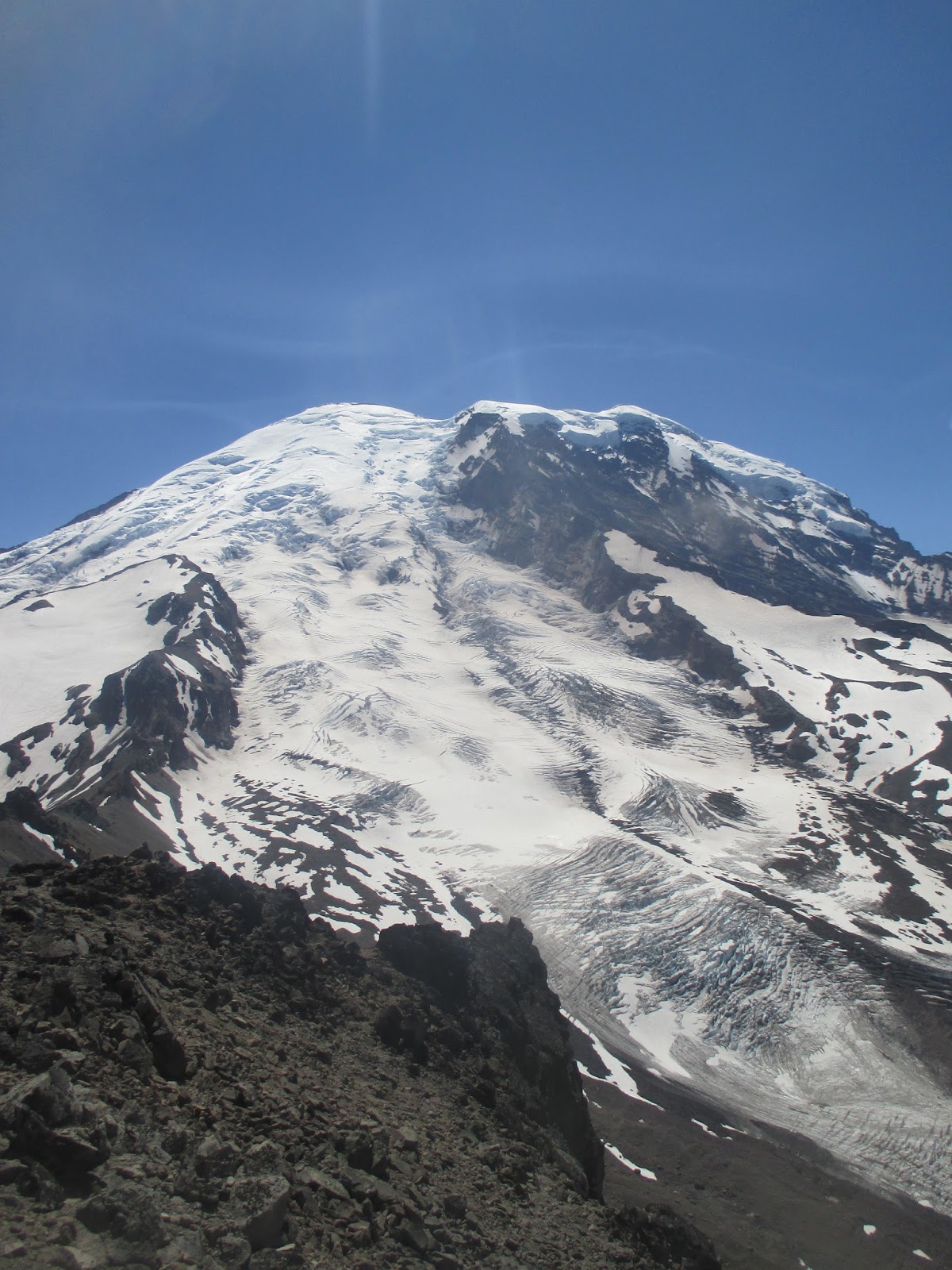
 On First Burroughs there is a trail split, which may be used to complete this hike as a loop trip on the return. From here, the trail descends about 100', before ascending 300' through some snow and ice to the summit of Second Burroughs Mountain. On the top, there is a uncommon stone bench, which offers a fantastic view of the Emmons Glacier, the steep arête of Little Tahoma, and of course 14,411' Mount Rainer itself. It is here that the ordinary hiker will stop, however the finest part of the trip is yet to come. Directly across you is Third Burroughs Mountain, however reaching it requires descending about 500', and then gaining over 800' on a steep climber's path through snow-fields; and of course regaining that on the return.
From the saddle between Second and Third Burroughs, the use-trail climbs abruptly upon the south-face of the mountain before passing 300' through some permanent ice-fields. Hiking poles are strongly recommended. Once up top of Thrid Burroughs, the panorama is simply dazzling. The entire northern and eastern sections of the park are visible as is the Seattle-Tacoma metro-area, and of course, the glacial moraines, massive glaciers, and crowning all Mount Rainier itself. After enjoying the vistas on summit, return the way you came, with all of its returning gain.
Hiked 8/9/2016. Pierce County, WA
 |
| View of the park from the parking lot |
 |
| You will encounter lots of casual walkers in the beginning |
 |
| Mount Rainier, from just near the beginning... |
 |
| Peaks along Sourdough Ridge Trail |
 |
| The North Cascades and Glacier Peak |
 |
| More crowded early trail... |
 |
| Mount Baker in the far distance |
 |
| A nice section |
 |
| Trail-side friend |
 |
| Nearing the Frozen Lake Saddle, and the Tree-Line |
 |
| Frozen Lake (6,700') |
 |
| Frozen Lake Saddle |
 |
| Ascending Burroughs Mountain trail |
 |
| Crampon/Ice Axe warning |
 |
| Going Up... |
 |
| Steepening a bit |
 |
| First snow-section |
 |
| Looking back towards Frozen Lake |
 |
| Little Tahoma, and Mount Rainier |
 |
| View West |
 |
| First Burrough's Mountain summit |
 |
| Second Burroughs Mountain from First |
 |
| Looking down into the valley |
 |
| Going up Second Burroughs |
 |
| Snow in August... |
 |
| Almost on 2nd |
 |
| Summit of Second |
 |
| A neat bench |
 |
| Summit view northwest |
 |
| Third Burroughs from Second |
 |
| Down into the Second and Third Saddle |
 |
| Third... |
 |
| Heading up Third from the Saddle |
 |
| First serious snowfield |
 |
| Going up... |
 |
| Rainier, Third and snow... |
 |
| Looking back down |
 |
| A dry section between the two snow-fields |
 |
| The steeper, second snow field |
 |
| Mount Rainier and the second snowfield |
 |
| Summit of Third |
 |
| Almost there |
 |
| Summit! |
 |
| Mount Rainier from the top |
 |
| View West |
 |
| Down into the valley |
 |
| Towards Seattle-Tacoma |
 |
| Northward |
 |
| Eastward |
 |
| Wow. |
 |
| View into a glacial moraine |
 |
| Glacier! |
 |
| Coming back towards Second... |
 |
| Up to Second |
 |
| Saddle between the two mountains |
 |
| Mountain Goats! |
 |
| Family of Four |
 |
| Zoom in... |


 While attaining the summit of Mount Rainier requires technical skills that the average hiker and I do not possess, a visit to the park is a worthy addition to any nature lover's life list. Many smaller, non-technical peaks jut against the ice-clad giant, the tallest of which is Burroughs Mountain, or as locally called "Third Burroughs". Burroughs Mountain is the culmination of a series of smaller peaks also named Burroughs, principally First and Second Burroughs. Though Burroughs Mountain proper (7,828') is just over half the height of Mount Rainier, the summit and its beholden views make it an admirable endeavor in itself. There is no trek I have done to date that even nears the unique spires of nobility found in this simple trip.
  The Trail: From the Sunrise Visitor Center, follow the signs up the Sourdough Ridge Trail towards Frozen Lake. The route gains elevation quickly as it ascends from the parking lot through lush meadows dotted by sub-alpine fir, and ringed by rocky peaks immediately above. Be sure to wear sunglasses on this trip, as the glaciers on the mountain reflects an enormous amount of the sun's rays.
  On First Burroughs there is a trail split, which may be used to complete this hike as a loop trip on the return. From here, the trail descends about 100', before ascending 300' through some snow and ice to the summit of Second Burroughs Mountain. On the top, there is a uncommon stone bench, which offers a fantastic view of the Emmons Glacier, the steep arête of Little Tahoma, and of course 14,411' Mount Rainer itself. It is here that the ordinary hiker will stop, however the finest part of the trip is yet to come. Directly across you is Third Burroughs Mountain, however reaching it requires descending about 500', and then gaining over 800' on a steep climber's path through snow-fields; and of course regaining that on the return.


No comments:
Post a Comment