
It has been said that on a clear day from the summit of White Mountain Peak, the beholden view stretches from the nearby crest of the High Sierra clear across the state of Nevada towards the distant contusions of the uplands near the western terminus of the Rocky Mountain in Utah. While it is dubious to say the least that such a singularly immaculate atmospheric condition to generate such a phenomenal visage has ever existed, or may ever again exist, it is for the views, albeit perhaps not in such dramatic fashion, that many trekkers continue to press themselves forward to the highborn summit. Although not technically consigned, White Mountain Peak deserves due credit for its sheer height, escalating rapidly over from the desert town of Bishop to its sky-scraping summit of 14,252', placing it in several distinctive categories as the third highest peak in California, the preeminent mountain in the contiguous United States between the Sierra Crest and Colorado, the highest point in Great Basin and Range geographical province, and the 44th tallest peak in North America. Needless to say with its extensive credentials, White Mountain attracts its fair share of peakbaggers seeking to collect a relatively straightforward 14er.
Fixed in the rain shadow of the Sierra Nevada, the White Mountains contain not only the oldest living organisms on the planet, the 5,000 year old Bristlecone Pine, but also boast the clearest and driest air not only in North America, but perhaps on the entire planet. In the higher reaches of the range above treeline, the mountains transitions to a climate on par with the other dry high-altitude steppes of the world such as Mendoza Province in Argentina of Andes and the Tibetan Plateau of the Himalaya.
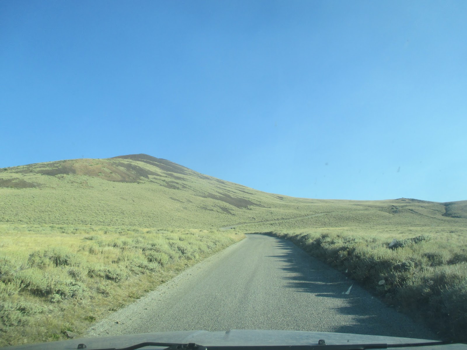
 While the route to the summit allows hiking on a non-maintained dirt road to the summit, the drive to the 11,700' trailhead is certainly an endeavor to be reckoned with; requiring a 16 mile one-way trip on a fair to poor dirt road. Sharp dolomite, steep downgrades, rough turns and a desolate location over two hours from the nearest town of Bishop, makes the drive almost an adventure in itself. However, with proper timing and speed, White Mountain Road can be traversed to the trailhead by a standard 2WD; just do not be out for breaking any speeding records, as my average in a Dodge mini-van was 12 MPH.
 Also remember, you are starting at nearly 12,000', and will be climbing to over 14,000': acclimatization is key. You cannot expect to leave home (unless you live above 8,000'...), drive to the trailhead, hike, and expect to feel fine. Even with proper acclimatization, you will feel some effects of altitude over 13,000'. While I have been a firm believer in using the prescribed drug Diamox to speed the acclimatization process, I have recently encountered some of the unpleasant side effects. This time, I chose to spend the night before the hike sleeping in the car at the Bristlecone Pine Visitor Center (10,100'), and use Advil (which some studies show can reduce your chances of mountain sickness by up to 30%) as a combat to AMS. To some degree this worked, but ultimately, it is your choice on how you want to acclimate for the high altitude. See later down this post for more information on AMS (Acute Mountain Sickness). Additionally, the UC Research team unlocks the gate at the normal trailhead, allowing you to drive to the Barcroft Station, shaving 4 miles and 800' off the trip. Check with them for details.
Stats:
Category: Very Strenuous (Because of the Altitude)
Miles: 15.8
Elevation Gain: 3,600'
Location: Inyo National Forest, White Mountain Wilderness, UC Barcroft Research Stations
 The Trail: From the locked gate, follow the trail as it steeply begins in ascent northward past the locked gate. After two miles of rather ordinary hiking, you will arrive at the University of California Barcroft Research Station, equipped with a mission specifically for monitoring the geology, biology, physiology, meteorology, and astronomy of high elevations. Some of the more interesting residents includes a large herd of lab sheep, friendly enough to the passing hiker. Just past the quite stoic science base, the trail moderately ascends 300' to a small saddle aside an astronomical observatory. Once on the top of the dip, the view both towards White Mountain Peak's stark snow-scattered south-face and the valley and hills awaiting you on route to the summit become apparent. From here, the vista towards various volcanic minerals and rock composites comprising White Mountain's utmost reaches are particularly striking in the morning and midday hours, when the sun's rays light them at the perfect angle.
 After making the saddle, the trail makes a substantial descent of near 400' to the wide and barren plateau resting between Barcroft station and the summit. Keep a sharp look out for Yellow-Bellied Marmots, eating their way through the summer months as an entire colony awaiting the long spell of winter. Once at the base of the valley, the trail begins a gradual ascent to a wide knoll at 13,250'. On the way to it you pass the White Mountain Wilderness sign. As the trail steepens, the air thins, and the mountain beckons. After cresting the knoll, the path makes an extremely steep downward turn of 250' to a windy col 1,200' below the crown of White Mountain.
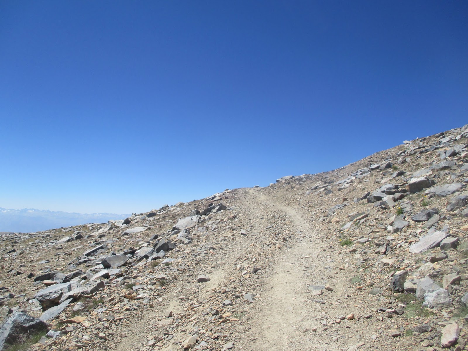
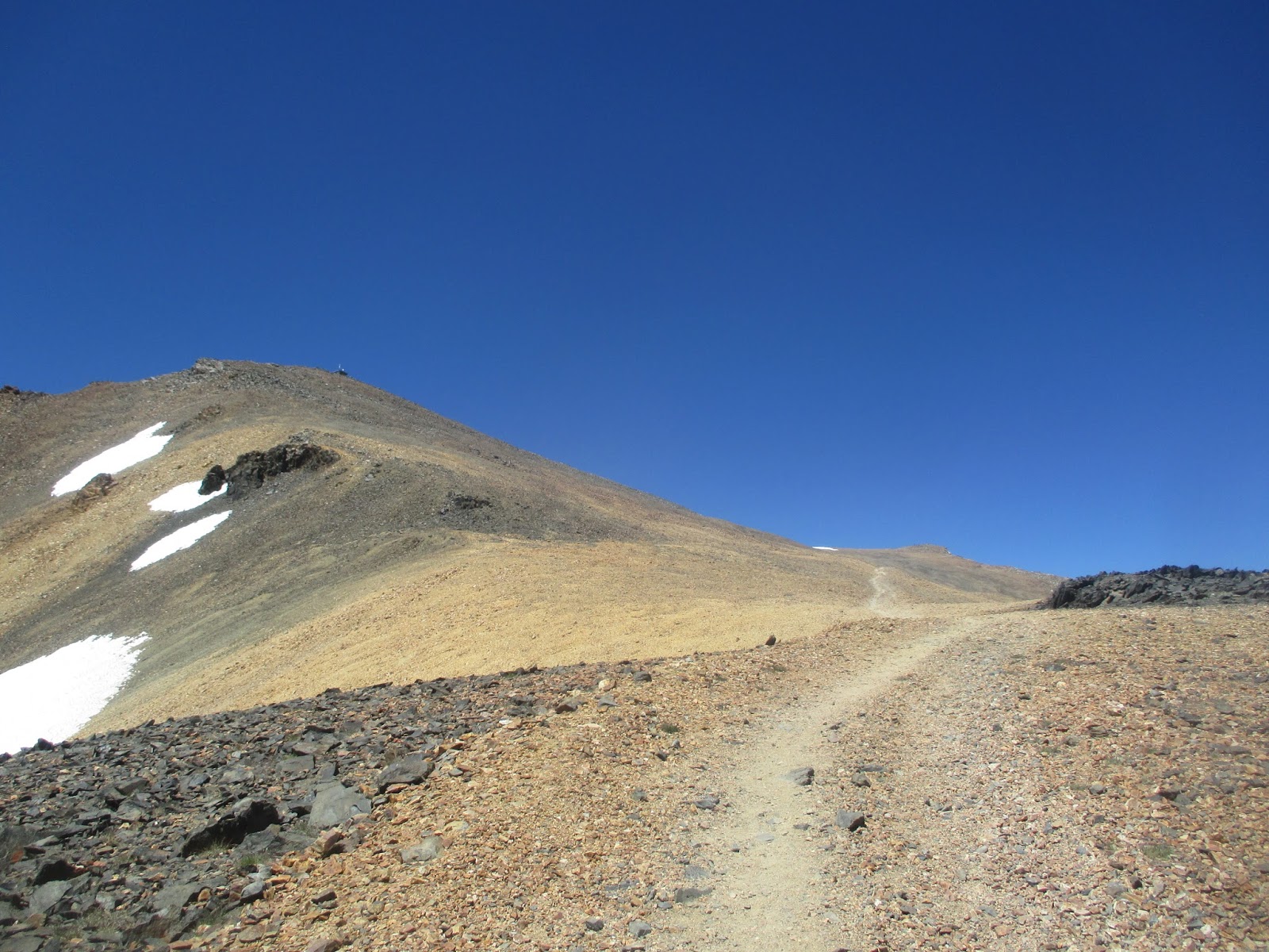
Here on up, the route roughens into a series of 14 separate switchbacks used to gain the crest of the peak. While the trail is free of snow by August and neither technical nor terribly steep, each step becomes a burden at this altitude, in particular note the final 400'. Alongside the trail at times, herds of Nelson Desert Bighorn Sheep can be found grazing on the summer greens and alpine flowers immediately below 14,000'. Grinding through each switchback through the peakbagger's most valuable virtues, patience and perseverance, the zenith will be yours to claim.
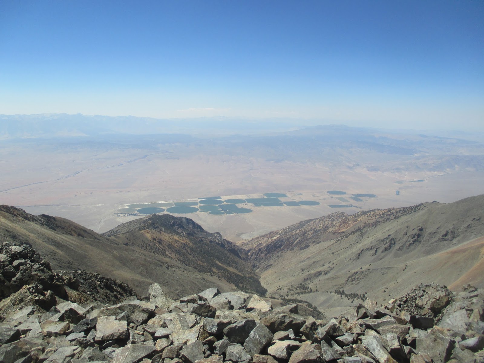
 Once on White Mountain, the view of the Sierra is spectacular stretching from Mount Whitney in the far south, past the Palisade Crest and its glistening glaciers, to Mount Ritter and Yosemite National Park. Directly below you is the upper end of the Owens Valley, the steepest gorge in North America, with mountains surging 10,000' over both sides of it. Eastward lies the Great Basin and the quiet desert haunts of rural Nevada, while just south lies the northern section of Death Valley National Park and some of its infamous sand dunes. On the summit there is even a small research hut, containing emergency water, food, and even a pair of beds. After taking in the vast vistas offered of Creation, return the way you came, with a special note for the uphill sections on the return. Keep in mind of both these uphill sections, the slowness of travel at altitude, the 90 minute dirt road drive, plus the additional hour to Bishop, when allotting time for travel. Needless to say, be prepared to spend a night either on the road or on the trail; when hiking in the Sierra Nevada/White Mountain, always have a fleece layer, rain shell, and headlamp even in summer.
Our Lady of the Assumption, Pray for Us!
Hiked 8/15/16. Mono County High Point.
High Altitude TIPS:
- Acclimate (AMS)! Spend the night before at the trailhead, or at the Bristlecone Visitor Center (10,100') Also, you could take Diamox: Acetazolamide taken 24 hours prior to arrival to altitude and the first 2 days at altitude is 75% effective in preventing AMS. It speeds up the acclimatization process in the body, stimulates breathing, raises blood oxygen and increases urination. Also, try 600 mg of Advil ever 4 hours at altitude. (which some studies show can reduce your chances of mountain sickness by up to 30%)
- HYDRATE! Drink even when you don't feel like it! The more you drink the better you will feel. Your urine should be clear, if its not drink more water! Replenish also with electrolytes.
- EAT! Most people will not want to eat above 11,000', but do! You need that energy, or you will get sick!
- Know Your Limits! Severe headache? Persistent nausea? Fatigue? These are sign of Acute Mountain Sickness! GO DOWN!
- Pace Yourself! Take frequent breaks! Charging up the mountain will give you both fatigue and AMS for sure.
- Talk to other hikers coming down about the Trail! This is a great way to know current trail/weather conditions and meet new friends!
- Bring extra food/water/clothing! Honestly, if you don't know this rule, don't climb White Mountain.
Recommended Prep Hikes (All can be found on this site):
1. One of the Three Saints of SoCal (Baldy, Jacinto or Gorgonio or any other High County Hikes above 8000'-these are always good trainer ideas for altitude hikes)
2. Three Tees Trail (Preps for the ups and downs)
3. Jones Peak via Barebone Ridge (Preps for how you will feel on a normal trail over 13,500')
4. Black Star Canyon (Preps for Mileage)
 |
| The beginning of the road... |
 |
| A flat section |
 |
| Going up... |
 |
| Around 11,000' |
 |
| 11,900' |
 |
| First views of White Mtn from the road |
 |
| Trailhead view |
 |
| Trailhead |
 |
| Start of the Trail |
 |
| Barren lands, and the Sierra Nevada |
 |
| Going up... |
 |
| Some neat rock formations |
 |
| Silence |
 |
| Barcroft |
 |
| The Station |
 |
| Friendly Sheep at 12,000' |
 |
| The trail after the Station |
 |
| Up to the first small saddle |
 |
| Astronomy dome on the saddle at 12,400' |
 |
| Cool rocks near the saddle |
 |
| Going down the first saddle...good view of White Mountain |
 |
| The wide plateau... |
 |
| Up again |
 |
| A bit steeper |
 |
| White Mountain Wilderness |
 |
| Nearing the small knoll at 13,250' |
 |
| On the windy col at 13,000', 1200' below White Mountain. |
 |
| West from the col |
 |
| Switchback #1 of 14 |
 |
| Starting to feel the altitude |
 |
| Alpine flowers |
 |
| Sill going |
 |
| Another switchback |
 |
| View into Nevada from 13,800' |
 |
| A neat orange/black prow |
 |
| Summit in sight |
 |
| There it is! |
 |
| A good break spot |
 |
| Into the town of Dyer, Nevada |
 |
| The final 400'... |
 |
| More! |
 |
| Moonscape |
 |
| Final switchback |
 |
| Summit... |
 |
| Here |
 |
| Into the upper Owens Valley 10,000' below |
 |
| Northward to Nevada's highpoint, Boundary Peak |
 |
| Northwest...hazy from fires... |
 |
| Southwest...hazy from fires... |
 |
| South |
 |
| Inside the summit hut |
 |
| Beds... |
 |
| Summit boulders |
 |
| Benchmark |
 |
| Summit Dog! |
 |
| More Bighorns on the descent at 13,700' |
 |
| Going down the switchbacks... |
 |
| Back in the wide valley... |
 |
| A final view to White Mountain |
 |
| A Marmot! |
 |
| Return elevation gain is the worst... |
 |
| From the first saddle looking south.. |
 |
| Mount Whitney and Mount Williamson,... CA's #1 and #2 |
 |
| Back at Barcroft... |


 While the route to the summit allows hiking on a non-maintained dirt road to the summit, the drive to the 11,700' trailhead is certainly an endeavor to be reckoned with; requiring a 16 mile one-way trip on a fair to poor dirt road. Sharp dolomite, steep downgrades, rough turns and a desolate location over two hours from the nearest town of Bishop, makes the drive almost an adventure in itself. However, with proper timing and speed, White Mountain Road can be traversed to the trailhead by a standard 2WD; just do not be out for breaking any speeding records, as my average in a Dodge mini-van was 12 MPH.
  Also remember, you are starting at nearly 12,000', and will be climbing to over 14,000': acclimatization is key. You cannot expect to leave home (unless you live above 8,000'...), drive to the trailhead, hike, and expect to feel fine. Even with proper acclimatization, you will feel some effects of altitude over 13,000'. While I have been a firm believer in using the prescribed drug Diamox to speed the acclimatization process, I have recently encountered some of the unpleasant side effects. This time, I chose to spend the night before the hike sleeping in the car at the Bristlecone Pine Visitor Center (10,100'), and use Advil (which some studies show can reduce your chances of mountain sickness by up to 30%) as a combat to AMS. To some degree this worked, but ultimately, it is your choice on how you want to acclimate for the high altitude. See later down this post for more information on AMS (Acute Mountain Sickness). Additionally, the UC Research team unlocks the gate at the normal trailhead, allowing you to drive to the Barcroft Station, shaving 4 miles and 800' off the trip. Check with them for details.
  The Trail: From the locked gate, follow the trail as it steeply begins in ascent northward past the locked gate. After two miles of rather ordinary hiking, you will arrive at the University of California Barcroft Research Station, equipped with a mission specifically for monitoring the geology, biology, physiology, meteorology, and astronomy of high elevations. Some of the more interesting residents includes a large herd of lab sheep, friendly enough to the passing hiker. Just past the quite stoic science base, the trail moderately ascends 300' to a small saddle aside an astronomical observatory. Once on the top of the dip, the view both towards White Mountain Peak's stark snow-scattered south-face and the valley and hills awaiting you on route to the summit become apparent. From here, the vista towards various volcanic minerals and rock composites comprising White Mountain's utmost reaches are particularly striking in the morning and midday hours, when the sun's rays light them at the perfect angle.
  After making the saddle, the trail makes a substantial descent of near 400' to the wide and barren plateau resting between Barcroft station and the summit. Keep a sharp look out for Yellow-Bellied Marmots, eating their way through the summer months as an entire colony awaiting the long spell of winter. Once at the base of the valley, the trail begins a gradual ascent to a wide knoll at 13,250'. On the way to it you pass the White Mountain Wilderness sign. As the trail steepens, the air thins, and the mountain beckons. After cresting the knoll, the path makes an extremely steep downward turn of 250' to a windy col 1,200' below the crown of White Mountain.
  Once on White Mountain, the view of the Sierra is spectacular stretching from Mount Whitney in the far south, past the Palisade Crest and its glistening glaciers, to Mount Ritter and Yosemite National Park. Directly below you is the upper end of the Owens Valley, the steepest gorge in North America, with mountains surging 10,000' over both sides of it. Eastward lies the Great Basin and the quiet desert haunts of rural Nevada, while just south lies the northern section of Death Valley National Park and some of its infamous sand dunes. On the summit there is even a small research hut, containing emergency water, food, and even a pair of beds. After taking in the vast vistas offered of Creation, return the way you came, with a special note for the uphill sections on the return. Keep in mind of both these uphill sections, the slowness of travel at altitude, the 90 minute dirt road drive, plus the additional hour to Bishop, when allotting time for travel. Needless to say, be prepared to spend a night either on the road or on the trail; when hiking in the Sierra Nevada/White Mountain, always have a fleece layer, rain shell, and headlamp even in summer.


No comments:
Post a Comment