 High on the far eastern ridge separating the steep trench of the Santa Ana River Valley from the bustling Big Bear Valley stands Sugloaf Mountain. At nearly 10,000' high, Sugarloaf is a rounded, forested peak that, while harking lovers of flora, may disappoint the weary hiker in search of a single spectacular viewshed. Nonetheless, although all-encompassing views are not to be held on summit, the long ridge-line climb offers plenty of opportunities for visual satisfaction, including absolutely phenomenal opportunities to gaze upon the stately alpine, snow-capped peaks of the cross-canyon San Gorgonio Wilderness.
As aforementioned, the botanist within would do well to embark on this trek as the vegetation is diverse and varied among its differing levels. First, the mid-mountain zone with its Jefferys, Ponderosas, White Firs and various east-side sages, gives way to a lush riparian woodland repeat with a gurgling Green Creek and its subsequent meadows, wildflowers, and Mountain Maples. Next comes the Upper-Mountain section, with less grasses and more Manzanita, and Chiniquapin scattered among White Fir and Sugar Pine. Finally, around 9,000', the subalpine is reached, whose fierce winds and long cold winters supports a monoculture of the Lodgepole. Scattered amount all of these zones, is the strong influence of the Mojave Desert, as this trip takes place along the eastern San Bernardino Mountains. Consequently, Western Juniper, Interior Live Oak, and even Beavertail cacti dot each region from the trailhead to just shy of the summit. For this botanical evolution to be possible, steep slopes are a requirement, and accordingly, this trip has many very steep sections. The trailside rewards visual and vegetative are worth it for any hiker interested in climbing the highest peak in the San Bernardino Mountains out of the San Gorgonio massif, Sugarloaf Mountain.
Stats:
Category: Strenuous
Miles: 10
Elevation Gain: 2,700'
Location: San Bernardino National Forest
Directions: HERE (Park as far as you feel comfortable. Unless you have a 4WD you may not make it to the trailhead. It is not that bad though, as parking anywhere on the dirt road only would add 1-2 miles, and little extra gain)
 The Trail: From the marked trailhead at the meeting of the road and creek, follow the off-roading path-turned trail (Sugarloaf Trail), as it meanders alongside Green Creek. Soon, the grade steepens, and for the next few miles, slower going will be a necessity. In some sections, the creek seems to have preferred the trail to its natural watercourse, and consequently, you may very well be doing some mud-hopping/stream marching. It is nothing to serious though, as being near water in these dry eastern parts is always refreshing. The meadows and flowers in season are remarkable, and those seeking for mountain meadows akin to those of San Gorgonio's South Fork prior to the devastating 2015 Lake Fire, will very well find these as a worthy a substitute as any while the former recover for later generations of trekkers. As the forest transitions from mid to upper, and finally to subalpine, try to pay a special notice of the different species of trees and, even soils, characterizing each zone. On this lonely trail, the only company you will have will undoubtedly be the occasional bark of a Merriam Chipmunk, a hoot of a Banded-Tail Pigeon, roar of the cicada and grasshopper, and the rustling of a Mule Deer. After about three miles of steep climbing, you will reach a small saddle at around 9,000', with a sign marking the way to Sugarloaf as 2 miles. This long and quite arduous final two mile-section follow the ridge, of just below it to the forested summit. Along the way though, the view south the the northside of the San Gorgonio Wilderness is a sight to indeed behold. After some dipping in the trail, the final 300' are brutal yet short as the signed summit lies just at the end of it. Average summit attempts take about 4 hours one-way. Return the way you came.
San Bernardino County, CA. Hiked 6/19/2017. No Adventure Pass Required.
Corpus Christi
 |
| The beginning of the road |
 |
| Trailhead signage |
 |
| Riparian woodland |
 |
| Some meadows |
 |
| Trail-turned-Creek |
 |
| Verdant Meadows |
 |
| Steeper section.... |
 |
| An example of the Mojave's influences |
 |
| Nearing the Sub-Alpine |
 |
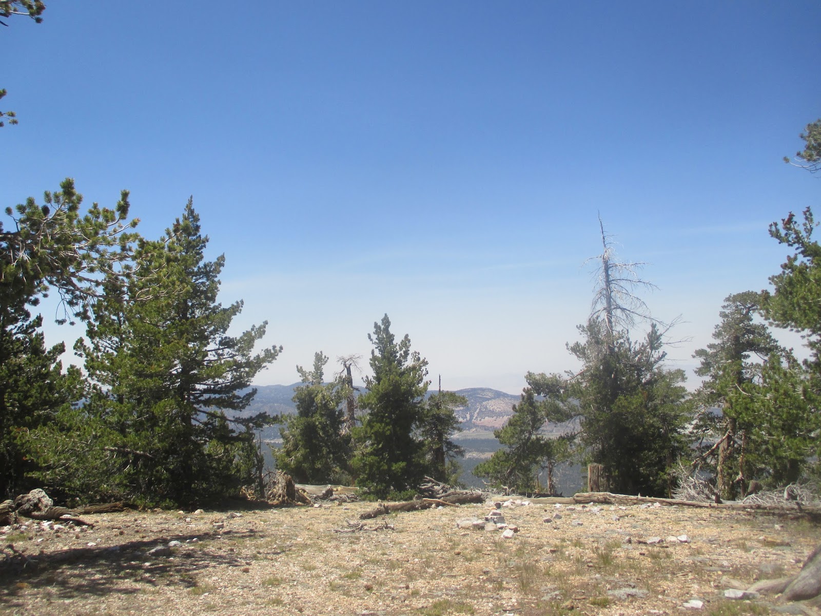
| Neat carins... |
 |
| Sugarloaf National Recreation Area |
 |
| A grand Western Juniper |
 |
| The small saddle |
 |
| First shots of San Gorgonio |
 |
| San Jacinto Peak and State Wilderness in background |
 |
| Up along the ridge |
 |
| Prickly Pear Cactus over 9000' high |
 |
| Lodgepole forest |
 |
| Northface |
 |
| Heartbar County, southeast |
 |
| San Gorgonio-Bernardino Mountain |
 |
| Summit |
 |
| Summit Sign |
 |
| View north |
 |
| Benchmark |
 |
| A nice framed view coming down. Note the burned trees in front of the snow-capped peak |
 |
| Big Bear Lake through the trees |
 |
| The far-off Mojave |
 |
| Start of a wildfire! |
 |
| Holcomb Fire |
 |
| Thank you firemen! (Fire started while we were coming down) |


 High on the far eastern ridge separating the steep trench of the Santa Ana River Valley from the bustling Big Bear Valley stands Sugloaf Mountain. At nearly 10,000' high, Sugarloaf is a rounded, forested peak that, while harking lovers of flora, may disappoint the weary hiker in search of a single spectacular viewshed. Nonetheless, although all-encompassing views are not to be held on summit, the long ridge-line climb offers plenty of opportunities for visual satisfaction, including absolutely phenomenal opportunities to gaze upon the stately alpine, snow-capped peaks of the cross-canyon San Gorgonio Wilderness.
  The Trail: From the marked trailhead at the meeting of the road and creek, follow the off-roading path-turned trail (Sugarloaf Trail), as it meanders alongside Green Creek. Soon, the grade steepens, and for the next few miles, slower going will be a necessity. In some sections, the creek seems to have preferred the trail to its natural watercourse, and consequently, you may very well be doing some mud-hopping/stream marching. It is nothing to serious though, as being near water in these dry eastern parts is always refreshing. The meadows and flowers in season are remarkable, and those seeking for mountain meadows akin to those of San Gorgonio's South Fork prior to the devastating 2015 Lake Fire, will very well find these as a worthy a substitute as any while the former recover for later generations of trekkers. As the forest transitions from mid to upper, and finally to subalpine, try to pay a special notice of the different species of trees and, even soils, characterizing each zone. On this lonely trail, the only company you will have will undoubtedly be the occasional bark of a Merriam Chipmunk, a hoot of a Banded-Tail Pigeon, roar of the cicada and grasshopper, and the rustling of a Mule Deer. After about three miles of steep climbing, you will reach a small saddle at around 9,000', with a sign marking the way to Sugarloaf as 2 miles. This long and quite arduous final two mile-section follow the ridge, of just below it to the forested summit. Along the way though, the view south the the northside of the San Gorgonio Wilderness is a sight to indeed behold. After some dipping in the trail, the final 300' are brutal yet short as the signed summit lies just at the end of it. Average summit attempts take about 4 hours one-way. Return the way you came.


No comments:
Post a Comment