Category: Very Strenuous (Because of the Class 2/3 trail-less climb up Jones Peak)
Miles: 6.9
Elevation Gain: 2850'
Location: Angeles National Forest
Directions: https://www.google.com/maps/d/edit?mid=zwnKszBY9wxE.kdBE-4VKNVd4
The Hike: You begin this trek near Mt.Wilson Park at the base of the San Gabriel Mountains, in the uppermost neighborhoods of Sierra Madre. From the quiet park you follow the paved Mt. Wilson Road up until the beginning of a real trail with some signage. Here is where the real hike begins, as you wind below some hilltop homes. After a few minutes, you realize that you are now really in the mountains, as the homes and roads are left behind. You are now on the Old Mt. Wilson Trail, which built in 1864 to the top of its namesake, is the oldest continuously used trail in Southern California. Ponder that as you stare back down to the busy I-210 Freeway and downtown Los Angeles 10 miles away. Below, is the Little Santa Anita Canyon, as rugged a canyon as any in the San Gabriels. Across the steep chasm, is abrupt Winter Ridge and the Winter Creek Trail, originating in Big Santa Anita Canyon on the ridge's other side. After gaining about 500', you come to the beginning of a small climber's path, and the end of a ridge. Take this climber's path as it switchbacks up the steep slope of Barebone Ridge, which culminates in your zenith for the day; Jones Peak.
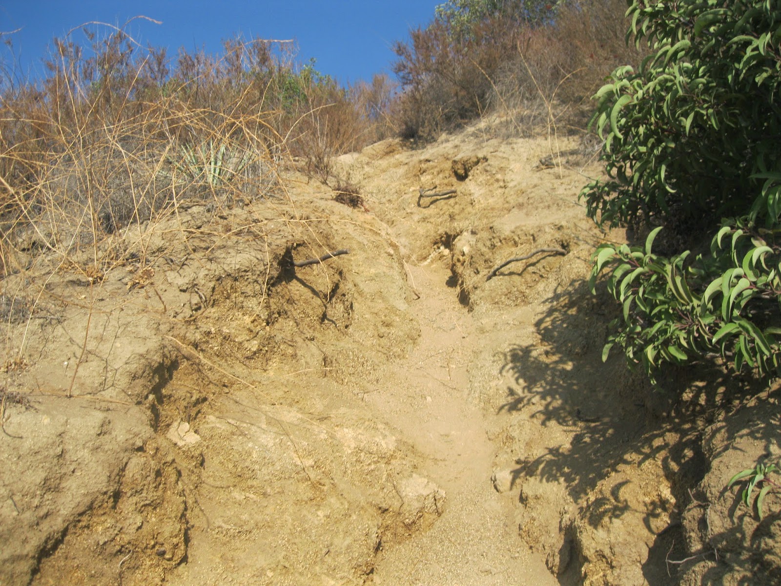
At a certain point the use-path diverges off the ridge, and disappears behind the north-side of the ridge. Trekking poles are a must past here, and this is also your last way out. After this, the route is trail-less and extremely steep; turning back past this point would result in a mean fall or worse. Its all or nothing after this. You in? Good, let's continue: After the trail leaves, its just you and the ridge. Take up the challenge as you climb up the gravelly slope, and use both your hands and feet to bench over the only Class 3 spot on the hike. The very beginning of the ridge-line scramble is the worst, and after about fifteen minutes you will, have to 'only' climb up a brutal Fire-Break. Follow this route up, and after passing one false summit, you will find yourself at the summit of Jones Peak (3,390'); quite the accomplishment. You will have just benched a ridge gaining 1550' in 0.75 miles! The grade on some spots was 70%, while the average was around 40%. Intense. Jones Peak summit, is really just a typical Front-Country range peak, but after the work to get there, it feels like so much more.
After spending some well-earned break time on the top, you will climb down the steep north-western slope of Jones Peak to a small saddle with the Baily Canyon trail coming up to it from Altadena, the easier way to the peak. From the saddle, you climb up the ridge in front of you, until you come to a trail-split. Take this crossover trail which leads back into Little Santa Anita Canyon, about two miles until it makes its way back down to the main Old Mt. Wilson Trail. From here, you can either go back to the car on the trail, or continue about one and a half miles a little bit up to Orchard Camp, to make this trip a little more relaxing after that intense climb. If you choose to continue, you will find yourself making a left at the trail-split, and hiking towards Orchard Camp, the half-way point up Mt. Wilson and an old resort spot from days gone by. On route to the camp, you pass by some magnificent alders, oaks and firs, as well as bubbling Decker Springs, the only year-round water source on this trail. When you arrive at the Orchard Camp (3000'), stop an enjoy the sounds of creation, while sitting atop the old ruins of 1920's resort, and under the shade of one of the oldest Oak Trees in Southern California, around 500-700 years old. After your sitting, follow the trail back down the canyon three and a half miles to the car, where the sign and sights of the city will be waiting for you.
Saint Margaret Mary Alaquoqe, Saint Hedwig, and Saint Gehard, Pray for us!
Hiked 10-16-2014. Los Angeles County. No Adventure Pass Required.
Warning: Do NOT, under ANY circumstances, attempt to climb Jones Peak via Barebone Ridge if the temperature is above 80 F.
 |
| Beginning the ridge climb |
 |
| Up the gravelly gully |
 |
| The standard route, the majority of the time on the ridge |
 |
| Nearing Jones Peak |
 |
| The City and the Mountains |
 |
| Crossover Trail after Jones Peak |
 |
| Jones Peak at the Crossover Trail |
 |
| At the end of the Crossover Trail |
 |
| Distant Mt. Harvard |
 |
| Decker Springs, surrounded by Fall Foliage. |
 |
| The Great Oak |
 |
| Near Orchard Camp |
 |
| Nearing the trip's end at the mouth of Little Santa Anita Canyon |


Read my comments on 3/11/2016, in Google "Jones Peak via Bastard Ridge." my hike up this ridge was surprisingly NOT difficult as Joseph writes above. It took me 2 hrs on the ridge which I measured as 20 degrees overall ( 1,770 ft gain over 0.9 miles of ridge). The crux was some 30 ft of steep Class 2 packed dirt 1/3 the way up. I met a guy with Labrador dog who was hiking down the ridge; he said that he had done it few times before. So to sum it up, take it nice & slow and do it when the temp is 80F or less and I promise you that you will enjoy it, novice or a seasoned hiker.
ReplyDelete