On the low point between the ridges separating the chasm of the Kaweah River Valley on one side and the verdant belt of the Giant Forest's Sequoia on the other, sits Panther Gap at 8,500' on the Westside of the Sierra. Roughly half-way between the verdant Wolverton trailhead and the beginning of the High Sierra marked by nearby Alta Peak, Panther Gap rests on a subalpine crossroads bounded both by deep valleys below and majestic, snow-covered granite peaks above and across it. Originally, it was my intention to climb 11,300' Alta Peak, however heavy snow conditions and poor weather prompted me to abandon that climb, and settle for Panther Gap and its nearby forests; making for nonetheless an extraordinary day in one of the nation's first protected area. A dense, quiet forest, snow-covered high peaks, and the calming peace of nature is sure to entrance anyone found of the experience only a day in the Sierra can offer.
Stats (To Panther Gap):
Category: Moderate
Miles: 6
Elevation Gain: 1300'
Location: Sequoia National Park
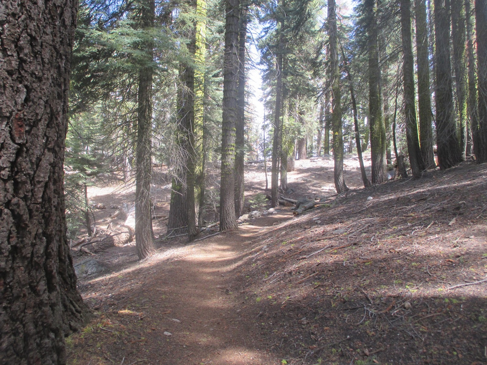
 The Hike: Once you enter onto the "Lakes Trail" at the Wolverton Trailhead, climb up the trail as it ascends into the dark forest of the upper reaches of the mid-zone Sierra forests. Soon, you will be greeted by the sights and sounds of small brooks and streas fed by the snowmelt of the peak high above. After the trail takes an obvious turn to the south, you will continue until you hit a trail divide 1.5 miles from the trailhead. As the Lakes Trail splits off towards Pear Lake and the Tablelands, your path remains steadfast on the route towards Alta Peak. In early season, typically late April through early June, substantial snow crossing will appear around 8500', though some snow spots may persist lower.
The 2016 Winter in the Southern Sierra was below average, yet in mid-May large sections of the mid-trail, and the complete upper trail was snow covered up to 3' deep. This snow is passable at certain times of the day with care, but be sure to be off it before it refreezes in the evenings. This section includes the transition zone into the subalpine realm, with white fir morphing into the Sierra red fir, and the sugar pines giving way to lodgepoles. After 3 miles, you will find yourself on Panther Gap, where it can be a bit windy. I continued up another 1000' towards Alta Peak before heavier snow conditions, and adverse weather turned me back. Nonetheless, I will be back to claim Alta Peak later this summer. Enjoy your afternoon in God's blissful mountains, and return the way you came.
Hiked 5-22-2016. Tulare County, CA. (Temp: 40 F, Wind: 20 MPH, Snow Depth: 1-3', Visibility: Moderate to Poor, Precipitation: Light Snow )
 |
| Trailhead |
 |
| Mid-Montane Zone (7200') |
 |
| Winter fighting Spring |
 |
| Snow patches around 7600' |
 |
| Trail... |
 |
| A peaceful brook |
 |
| Trail Split, note clouds rolling in |
 |
| First significant snow crossing on the trip |
 |
| Climbing down a small snow canyon |
 |
| Upper Section up to Panther Gap: all snow |
 |
| Very cold here, around 40 F with 20 MPH |
 |
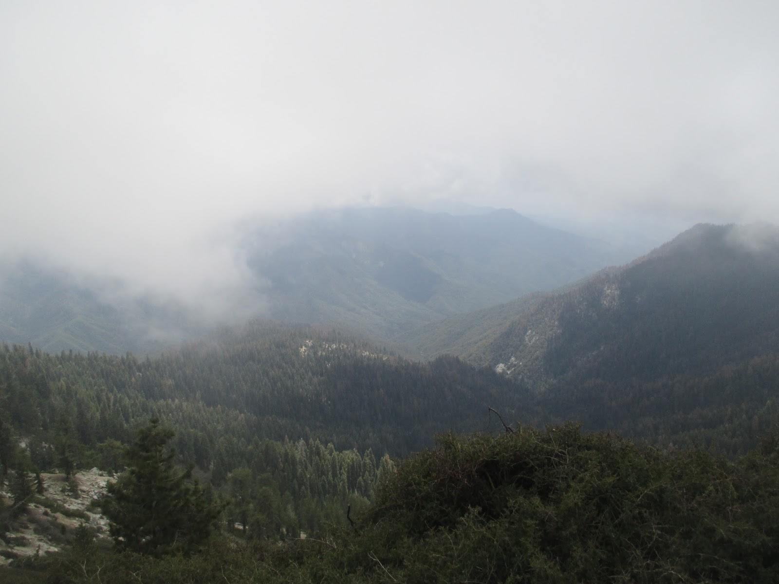
| Panther Gap...no views today.. |
 |
| Continue onto the southside of the ridge towards Alta Peak |
 |
| Looking down Kaweah Canyon |
 |
| Do you see the bear in the rock? |
 |
| Kaweah Canyon |
 |
| Marmot peeking out at me |
 |
| Cloud played hide and seek with the mountains all day. |
 |
| Snow starting again |
 |
| A small spring |
 |
| A nice dry section |
 |
| Split Rock, where we called it a day |
 |
| Sun finally comes out to show us the High Sierra a bit |
 |
| Towards the Central Valley |
 |
| A deer by the Sequoia on the drive out... |


 The Hike: Once you enter onto the "Lakes Trail" at the Wolverton Trailhead, climb up the trail as it ascends into the dark forest of the upper reaches of the mid-zone Sierra forests. Soon, you will be greeted by the sights and sounds of small brooks and streas fed by the snowmelt of the peak high above. After the trail takes an obvious turn to the south, you will continue until you hit a trail divide 1.5 miles from the trailhead. As the Lakes Trail splits off towards Pear Lake and the Tablelands, your path remains steadfast on the route towards Alta Peak. In early season, typically late April through early June, substantial snow crossing will appear around 8500', though some snow spots may persist lower.


No comments:
Post a Comment