 The rooftop of Southern California is located within the heights of the region's fantastical San Gorgonio Wilderness. Few places in the world offer such a vast array of extremes in so confined a space as the Southland, and it is in the San Gorgonio Wilderness that that extraordinary aspect of diversity, taken for granted by most in the region, can be fully appreciated. From the crest of these lofty ridges and bulwark granite blocs, the sound of the woodpecker echoes in a stunningly similar environment as found within the Arctic Circle. Along the trails needed to gain these crests, a lush coniferous and deciduous forest are passed; organism for more reminiscent of a cooler, more moist climate. Looking down from the summits, views towards the Mojave appear as do vistas reaching far out to the distant Pacific:
In truth, when the hiker stands along these highest ridges of the wilderness looking about himself, he essentially is witnessing the ecologic transformation of the earth from the tropics to the arctic, from the equator to the North Pole, within the viewfinder of a smartphone camera.
The San Gorgonio Wilderness is a land replete with alpine wonders and montane delights second to none south of the Sierra. This trip, the Forsee Loop, covering the fourth highest peak in Southern California (Anderson Peak), and the entire western edge of the great San Bernardino Divide, is surly among most golden trips the within this region of the Golden State.
Stats:
Category: Very Strenuous
Miles: 17.3
Elevation Gain: 4,600'
Location: San Bernardino National Forest, San Gorgonio Wilderness
Directions: HERE: Note-The road to Forsee Trailhead (1.5 miles) if a fair dirt road, passable in 2WD cars going slowly.
 The Trail: From the Forsee Trailhead at 6,700', take the path as it winds through the mid-montane forest habitat comprised mainly of Incense Cedars, White Fir, and Jeffery Pine. The trail is steep even in the early goings, and it only increases its grade to the crest at 10,400'. In about 0.5 miles, you will reach a trail split with one path heading east, marked "Trailfork Springs", and the other heading west, marked "John's Meadow." This essentially is the origin of this loop trip, as you will ascend one side, and exit the other. I recommend heading up the main headwall of the mountain towards Trailfork Springs, as the tight, compact, and heavily shaded switchbacks are more psychologically rewarding than the long, winding, exposed route past John's Meadow is.

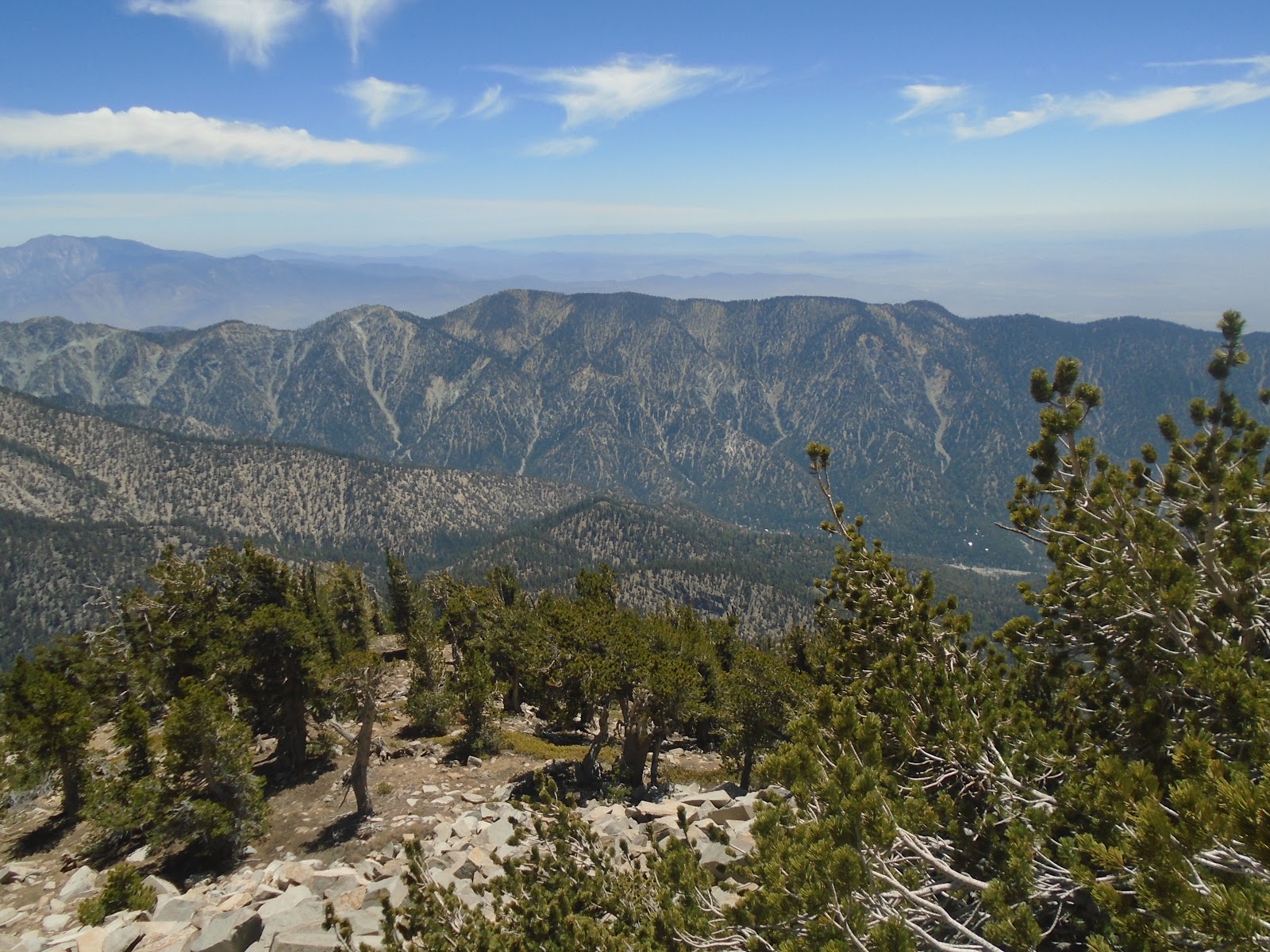
Bear in mind, this headwall is steep, and the trail reflects this in its grade. The narrow single-track trail though is extensively wooded in its early stages by White Fir, and around 9,000', gives way to Lodgepole Pines. This section is relatively straight forward; bear the switchbacks patiently, and enjoy the expanding views across Santa Ana Canyon. Close to 10,000', after the once thick forest has thinned considerably, view expand towards the San Gabriel Mountains, and the nearly-even-with-your feet, Mount Baldy. At 10,400', and six miles from the trailhead, you reach Trailfork Springs and Divide, the former of which usually hold reliable water though mid-summer at least. At the divide, take the Lower San Bernardino Divide Trail towards "Camp Angelus", and begin heading west. After about ten minutes, you will reach another trail split, with the Upper San Bernardino Divide Trail. From this point, there is a rising knoll on your left. This is Anderson Peak, the fourth highest mountain the Southern California at 10,840'. The route to its summit is competently cross-country, about 0.5 miles and 300' of elevation gain. Bring a good topo map for guidance on reaching it. From its tree-strewn summit, the viewshed of the highest peak in the wilderness, San Gorgonio Mountain, is breathtaking. Rising like a grey giant out of the sky, it towers over all other mountains its vicinity between mid-Mexico and the Sierra Nevada.
 After relishing the splendid summit view, follow your cross country route back to the trail split with the Upper San Bernardino Peak Trail, and then continue along the ridge-line to the west, as the path then begins to climb toward boulder-stacked San Bernardino East Peak. The views into the Inland Empire are best from this peak, though the clarity of the cities is highly dependent upon seasonal lower atmospheric conditions, such as smog and fog. That being said, the drop into Mill Creek Canyon is precipitous to say the least, and represent a drop of over a vertical mile, seemingly just below your feet! From the summit of San Bernardino East Peak (10,691'), the trail drops considerably into a small saddle straddling the gap between San Bernardino East Peak and San Bernardino Peak (10,649'). Rising again, the trail being the traveler to the summit of San Bernardino Peak, which due to the large numer of limber pines on its summit, does not offer nearly the same terrific views its higher parent peaks offered. Still, this is a classic So Cal mountain, and historically significant, as just 400' below its summit, at Washington Monument (10,240') you pass a surveying site from 1852. This site was erected up by Colonel Washington of the U.S. Army just six years after the United States acquired California from Mexico in the Treaty of Guadalupe-Hidalgo. He and his men calculated a baseline datum, which would set the cartographic precedent for all future maps of the region, influencing even today the arrangement of the area's road layout.

From the Washington Monument, take the trail down the westface of San Bernardino Peak, as it winds almost endlessly though oceans of montane chaparral, comprised mainly of foul-smelling Chinquapin, and more pleasant Manzaita. Around 8,400', there is a marked trail divide towards John's Meadow. This path is not shown on most maps, but is certainly obvious, and will connect you to John's Meadow, and 2.5 miles from there, the long-awaited trailhead.
Hiked 6/5/2018. San Bernardino County, CA. No Adventure Pass Required. No Wilderness Permit Required for Day Hiking.
 |
| Overview of the Loop (Coutesy of Hikingjim.blogspot.com) I added Anderson Peak to this |
 |
| Forsee Trailhead Parking Lot, (9:08am) |
 |
| Trailhead |
 |
| Early Trail |
 |
| Mind-Montane Forest through Incense Cedars |
 |
| Entrance to the Wilderness |
 |
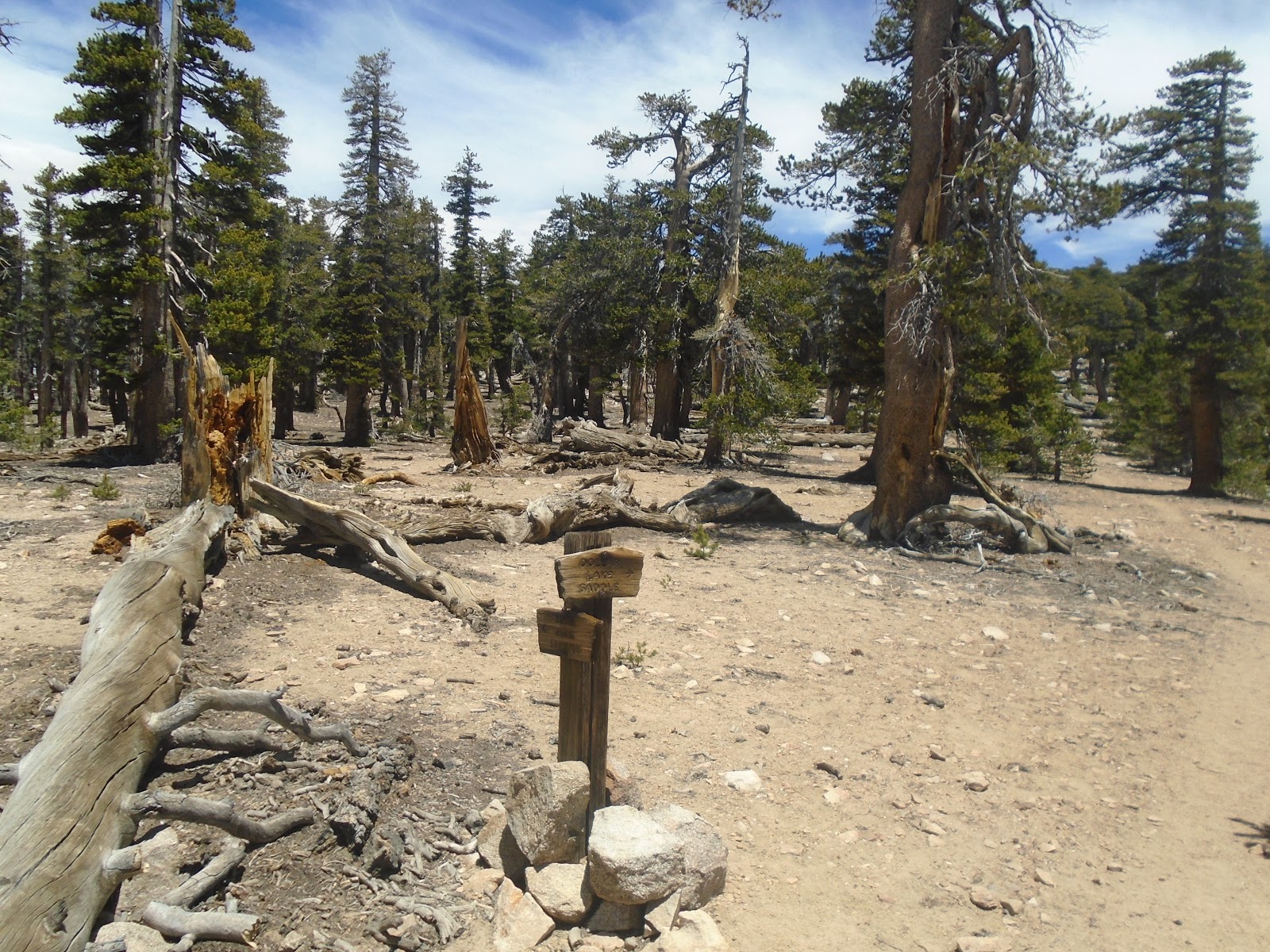
| The origin of the Forsee Loop |
 |
| Gooseberries (not in season) |
 |
| Shelf Fungi on a White Fir |
 |
| A sapling Insence Cedar regrowing after the 2015 Lake Fire |
 |
| Resporouting Black Oak |
 |
| Beautiful Flower |
 |
| Looking down into Santa Ana Canyon |
 |
| Highly regional Metamorphasized mafic intrusive rock |
 |
| Going up... |
 |
| Neat Succulents |
 |
| Entering the Sub Alpine Realm around 8800' |
 |
| Sugarloaf Mountain... |
 |
| Burned Area from 2015 Lake Fire at 9,000' |
 |
| San Bernardino Ridge from Trail |
 |
| Devastated forest acres... |
 |
| View west from trail |
 |
| San Bernardino East Peak Ridge from Trail (9,900') |
 |
| Sub Alpine Lodgepole and Limber Pine Forest |
 |
| Trailfork Springs Divide |
 |
| Trailfork Springs |
 |
| On the San Bernardino Divide |
 |
| Pure Lodgepole Forest |
 |
| Trail split, go east to Anderson Peak |
 |
| Cross Country to Anderson Peak |
 |
| About 200' of elevation gain |
 |
| Going up more... |
 |
| Small saddle on X-country route to Anderson Peak |
 |
| Winding to the summit |
 |
| Anderson Peak (10,840') |
 |
| Summit view down the SB Divide |
 |
| View north into Big Bear Valley |
 |
| View towards San Gorgonio Mtn |
 |
| Descent into the hazy skies below... |
 |
| Mt. San Gorgonio, 11,502' |
 |
| San Gorgonio and San Jacinto Peak (background) |
 |
| Santiago Peak in the far distance over the smog |
 |
| Eastern side of the San Bernardino divide |
 |
| Yuciapa Ridge |
 |
| Close up of SG Mtn |
 |
| Heading back on the Trail towards San Bernardino East Peak |
 |
| Route to San Bernardino East Peak, 3:00pm |
 |
| Nearing the summit |
 |
| San Gorgonio Wilderness... |
 |
| Sugarloaf Mtn...hiked that last year! |
 |
| SB East Peak summit (10,691') |
 |
| Down into Mill Creek Canyon |
 |
| Lodgepoles and manzanita... |
 |
| San Bernardino Peak from SB East Peak |
 |
| Alpine flowers! |
 |
| Final approach to SB East Peak |
 |
| San Bernardino Peak (10,649') |
 |
| Big Bear Lake |
 |
| Washington Monument marker |
 |
| Site from 1852 survey |
 |
| View into the Inland Empire, and the San Gabriel Mountains |
 |
| Coming down San Bernardino Peak |
 |
| Descending with a view of the distant Mount Baldy |
 |
| Think montane chaparral |
 |
| Beginning John's Meadow spur trail |
 |
| Descending through chaparral |
 |
| White Fir reemerging around 8,400' |
 |
| Spur trail... |
 |
| John's Meadow |
 |
| Forsee Creek |
 |
| Sunset in the San Bernardinos... 6:30pm |


 The rooftop of Southern California is located within the heights of the region's fantastical San Gorgonio Wilderness. Few places in the world offer such a vast array of extremes in so confined a space as the Southland, and it is in the San Gorgonio Wilderness that that extraordinary aspect of diversity, taken for granted by most in the region, can be fully appreciated. From the crest of these lofty ridges and bulwark granite blocs, the sound of the woodpecker echoes in a stunningly similar environment as found within the Arctic Circle. Along the trails needed to gain these crests, a lush coniferous and deciduous forest are passed; organism for more reminiscent of a cooler, more moist climate. Looking down from the summits, views towards the Mojave appear as do vistas reaching far out to the distant Pacific:
 The Trail: From the Forsee Trailhead at 6,700', take the path as it winds through the mid-montane forest habitat comprised mainly of Incense Cedars, White Fir, and Jeffery Pine. The trail is steep even in the early goings, and it only increases its grade to the crest at 10,400'. In about 0.5 miles, you will reach a trail split with one path heading east, marked "Trailfork Springs", and the other heading west, marked "John's Meadow." This essentially is the origin of this loop trip, as you will ascend one side, and exit the other. I recommend heading up the main headwall of the mountain towards Trailfork Springs, as the tight, compact, and heavily shaded switchbacks are more psychologically rewarding than the long, winding, exposed route past John's Meadow is.
 After relishing the splendid summit view, follow your cross country route back to the trail split with the Upper San Bernardino Peak Trail, and then continue along the ridge-line to the west, as the path then begins to climb toward boulder-stacked San Bernardino East Peak. The views into the Inland Empire are best from this peak, though the clarity of the cities is highly dependent upon seasonal lower atmospheric conditions, such as smog and fog. That being said, the drop into Mill Creek Canyon is precipitous to say the least, and represent a drop of over a vertical mile, seemingly just below your feet! From the summit of San Bernardino East Peak (10,691'), the trail drops considerably into a small saddle straddling the gap between San Bernardino East Peak and San Bernardino Peak (10,649'). Rising again, the trail being the traveler to the summit of San Bernardino Peak, which due to the large numer of limber pines on its summit, does not offer nearly the same terrific views its higher parent peaks offered. Still, this is a classic So Cal mountain, and historically significant, as just 400' below its summit, at Washington Monument (10,240') you pass a surveying site from 1852. This site was erected up by Colonel Washington of the U.S. Army just six years after the United States acquired California from Mexico in the Treaty of Guadalupe-Hidalgo. He and his men calculated a baseline datum, which would set the cartographic precedent for all future maps of the region, influencing even today the arrangement of the area's road layout.


No comments:
Post a Comment