

Like a great wall separating the cool and hospitable ocean-influenced Los Angeles Basin from the harsh winds and heat swells of the Mojave Desert stands the Middle High Country of the San Gabriel Mountains: A long line of peaks with numerous summits scraping out barely over 8000' in the west, to topping 9,000' in the east. Along this impressive barricade stands the rugged and remote Hawkins Ridge, with its four minor summits, as well as Throop Peak (9,138') , and isolated Mount Islip (8,250'). Each one of these mountains are on or near the Pacific Crest, which separates the Pacific Watersheds from the Great Basins'. Each one of these destinations, whether it be Throop, Islip, or the Hawkins Ridge, could be done alone in a worthy day-hike, but to those of strong endurance tackling all three, which includes bagging six distinct peaks, would certainly be an adventure to remember.
Stats:
Category: Strenuous
Miles: 16
Elevation Gain: 4,700' (some roller-coaster action)
Location: Angeles National Forest, Sheep Mountain Wilderness (No Permit Required)
Directions: From the I-210 in Azuza, exit CA-39 (Azuza Ave) and follow it 30 minutes from the freeway into the mountains, after some upgrades, take CRYSTAL LAKE ROAD on your right (just before Ca-39 ends), and take this road until in ends at Crystal Lake Campground. Park here.
The Trail: From the Crystal Lake Trailhead (5,811'), follow the lower Windy Gap Trail as it winds through some oaks and pines, but mainly burned vegetation from the 2002 Curve Fire. You soon pass a paved road, and then about 0.25 miles after that the Hawkins Fire Road. This is your new route. The sign says in is 3.7 miles to your first peak, South Mount Hawkins. Take the abandoned fire-road east, and then south(some spots are badly eroded in places) past a seasonal spring (the only water directly on route). The road gradually gains elevation, which gives you more of an opportunity to enjoy the scenery around. Windy Gap and Mount Islip stand to the north, Crystal Lake Basin below, and the sprawling Southland further down. Once you find yourself on the summit of South Mount Hawkins (7,783'), you can stomp on the old ruins of a Fire Lookout tower, which burned in a blazing inferno over a decade ago. Despite the fire, the north-slope of this peak is heavily forested.
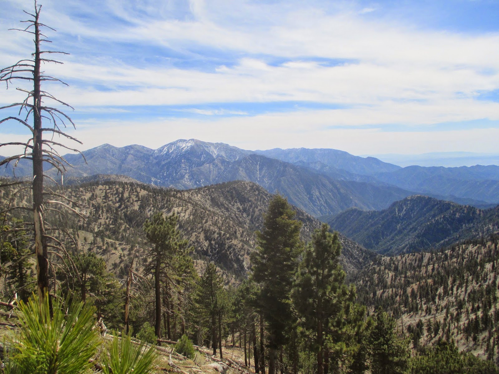
 Once done on top, take the path right back down to the junction 0.5 miles away onto the Hawkins Ridge Trail. This recent trail skirts the next to peaks, Sadie Hawkins (8,050') and Middle Hawkins (8,505'), over the next 2.5 miles on its impressive namesake ridge. You can do your homework on a topographical map, then make your peak attempt to these two blissful bumps. After you steep ascent of the Hawkins Ridge you will find you self at the junction with the Pacific Crest Trail, 8,411', and 7.5 miles from the start. From here take the trail eastward 0.5 miles to a small climber's path up Mount Hawkins (8,850'), and then from there another 0.75 miles to the day's highlight, Throop Peak (9,138'). Throop Peak is named after Dr. Amos Throop the founder of what is now known as the California Institute of Technology (Cal-Tech), and this impressive summit honors his legacy. From here you can gaze into the wild chasm of the Iron Fork of the San Gabriel River below you, Mounts Baden-Powell and San Antonio to the east, Telescope Peak (Death Valley), the Sierra Nevada, and the Mojave Desert to the north, the peaks culminating to where you are in the west and as far as distant San Clemente Island to your south (120 miles away). The views are truly spectacular.
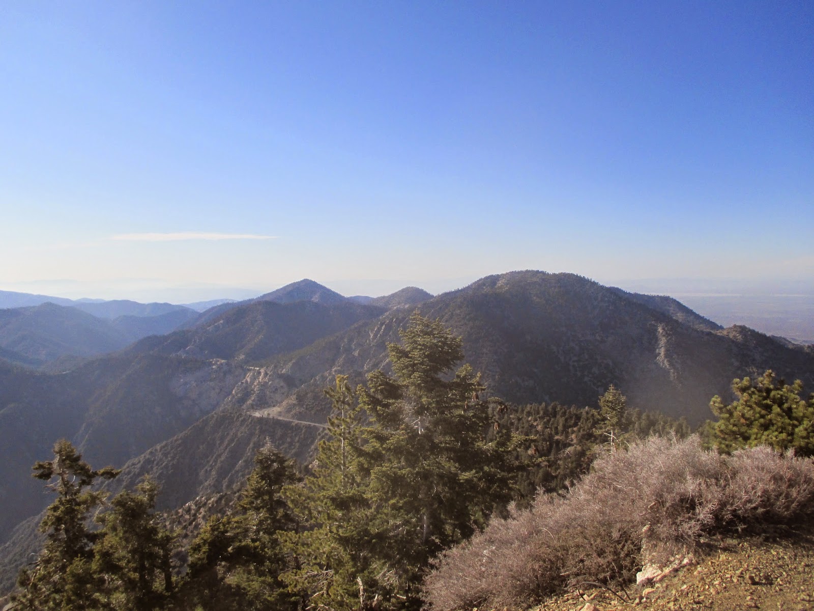
 After your time on summit is done, retrace your steps back to the Pacific Crest Trail, and follow it down through some absolutely blissful stands of White Fir and Sugar Pine, 2 miles to Windy Gap at 7,570'. Take a breather here before the last 800' up to Mount Islip, 0.8 miles away. Take the recently built Islip Crest Trail, and follow it along the ridge to the summit, topped by a small cabin from the 1930's. From the summit you have suburb view of the untamed San Gabriel Wilderness and Bear Canyon to the west and the Hawkins Ridge and Throop Peak to the east. Once done up on the zenith, take that same trail down to Windy Gap and follow the trail from 2.6 miles back to the Crystal Lake Trailhead. A most inspiring and exhausting day in God's wondrous Creation tackling the San Gabriel Six-Pack of Peaks!
Passion of Christ, Strengthen Me!
Hiked March, 30, 2015
Advenure Pass Required. Los Angeles County
 |
| Google Earth Layout of the View |
 |
| Hawkins Fire Road |

 |
| Erosion on the Fire Road |
 |
| Crystal Lake Basin |
 |
| Hawkins Ridge |

 |
| Windy Gap Pass and Mount Islip |
 |
| Pine-filled route! |
 |
| S. Mt. Hawkins Summit |


 |
| Along Hawkins Ridge |


 |
| Going up Middle Hawkins (Class 2) |


 |
| SNOW! |


 |
| PCT TRAIL |

 |
| Throop Peak (9138') |

 |
| Snow Streaked Baldy |


 |
| Islip Cabin |

 |
| Bear Canyon |

 |
| Trail back down to trailhead |
Great adventure!
ReplyDelete